Day 11 5.31
I decided to skip visiting Valley of Fire because of the heat. The sun is so freakin’ hot here. Also, today was the last day my National Park Pass was valid & I could use it to get into Red Rocks Conservation area just outside of Vegas. I’ve heard about this park, but never had visited. This is my third trip to Vegas: 1. I was in Zion hiking one year & Sara called me & told me she was flying into Vegas the next day to spend the weekend with Kevin…did I want to pick her up at the airport the next day & spend the day with her? You bet! That was my one time on the strip. 2. A couple of years later I buzzed through their crazy traffic & went & saw Lake Mead & the ugly dam attached to it. 3. This time I was lucky in the fact that Red Rocks is just outside of North Vegas & the two errands I needed to run (Total Wine & REI) were also in North Vegas…so once again I missed Vegas’s lunatic traffic. You can tell…I’m not a fan of Las Vegas.
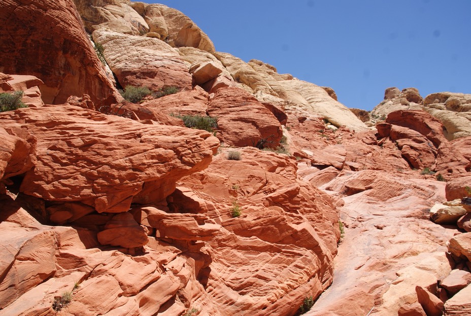
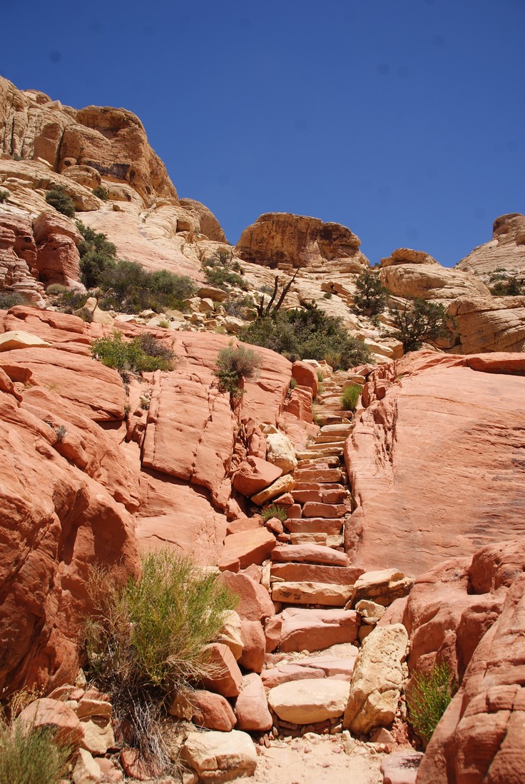
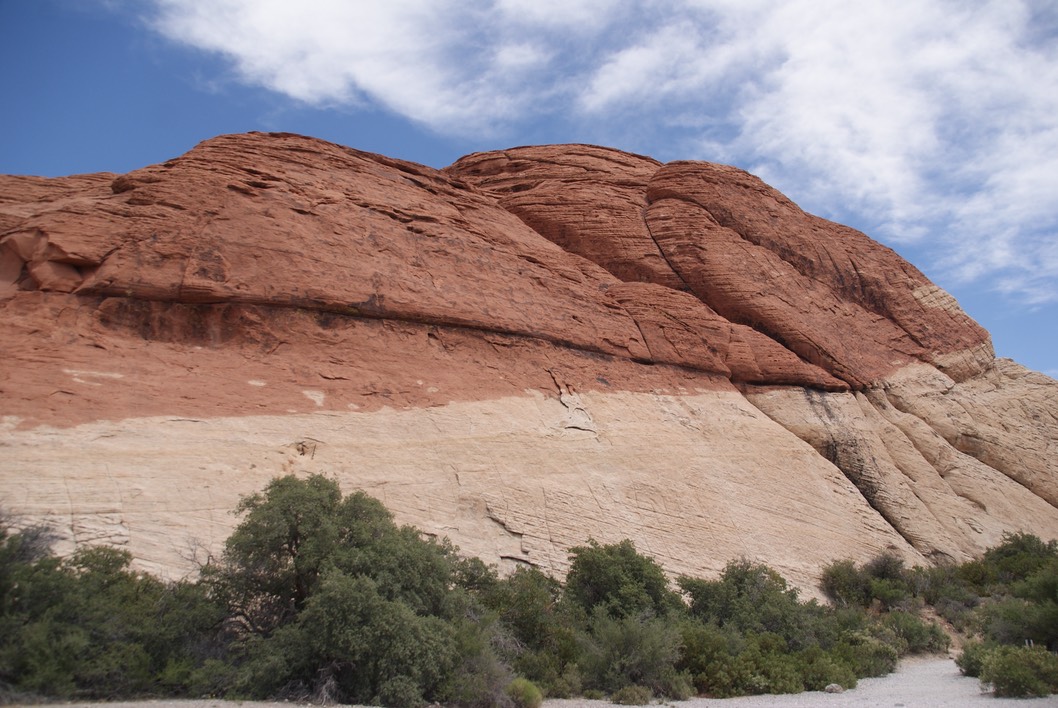
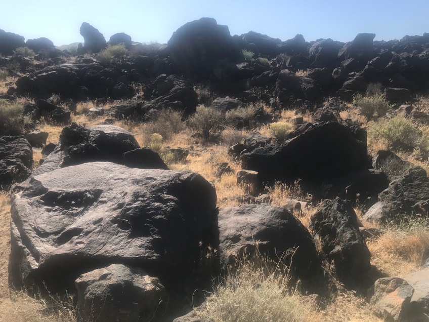
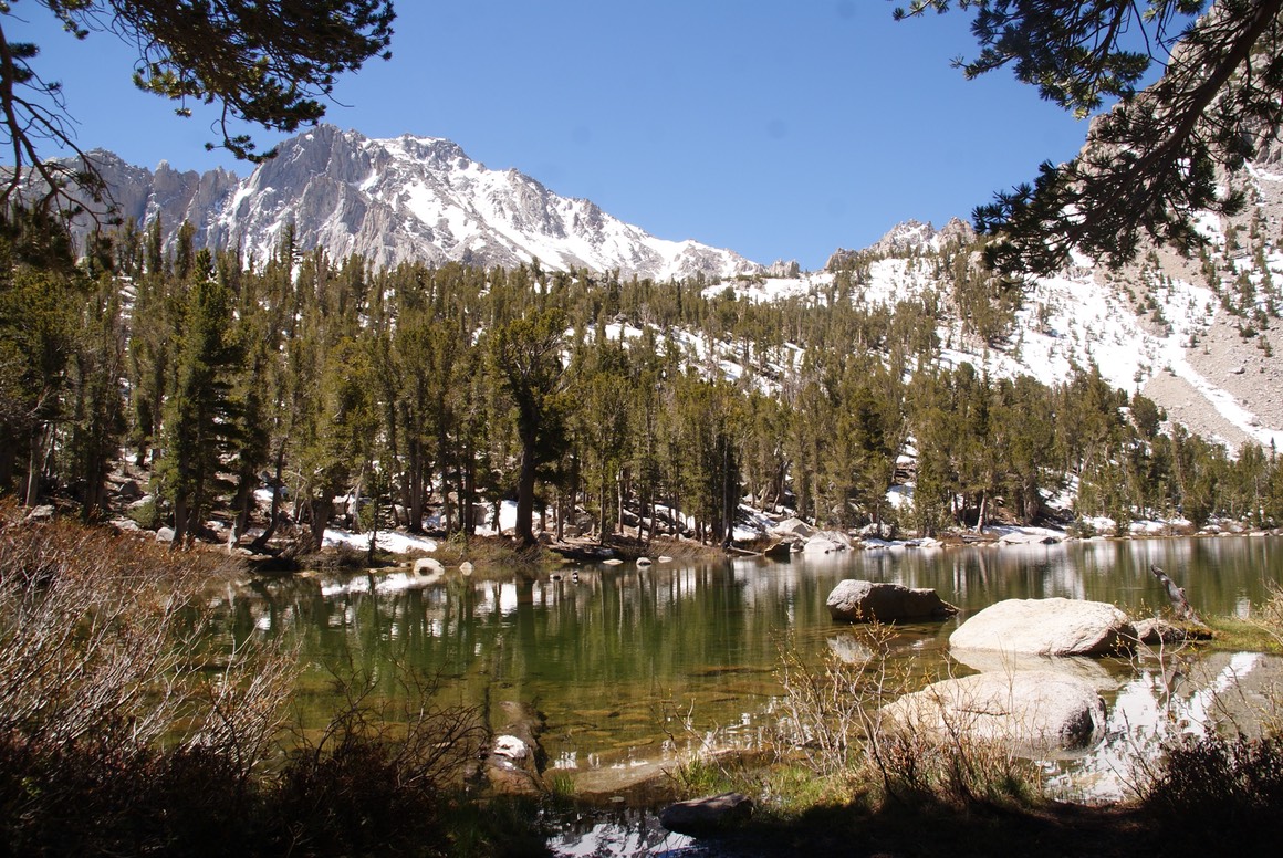
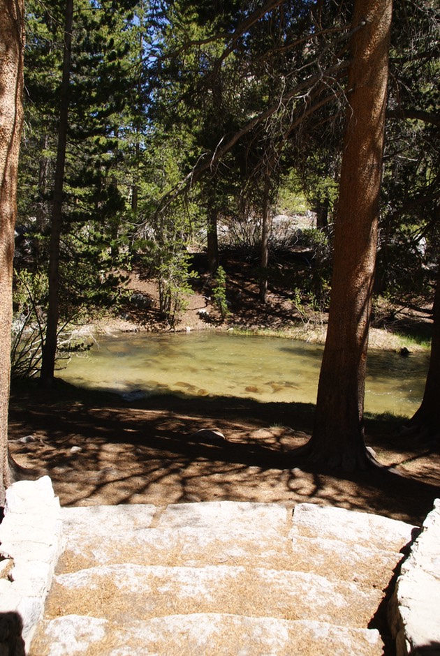
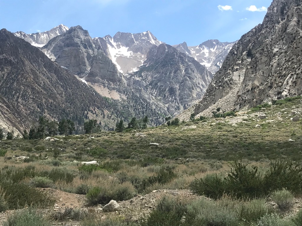
So, I found myself in Red Rocks & used my pass for the last time. There is a 13 mile scenic drive with several hiking trails veering off the road. It’s a really pretty park & is actually part of the Mojave Desert. I started the drive, then stopped to hike one of the trails the guy at the VC recommended to the Tanks. Which in rock country are shallow bowls that hold water…in this case it was a huge swimming pool size area, but it was all dry this time of year.
It started out as a really good trail, then headed up the rocks, then disappeared. There were only a couple of cairns to mark the way, & it ended up being more route finding & scrambling that I anticipated. I lost the trail once, but soon found it again.
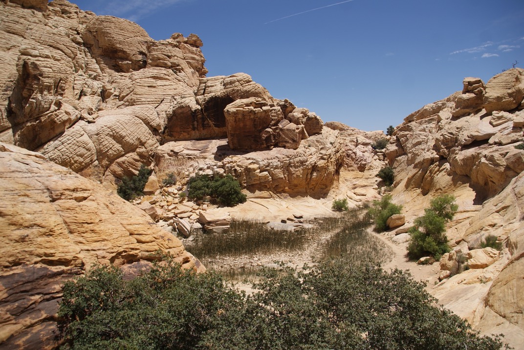
The dried up Tanks (where the reeds are growing).
The color variations in the rocks here are stunning.
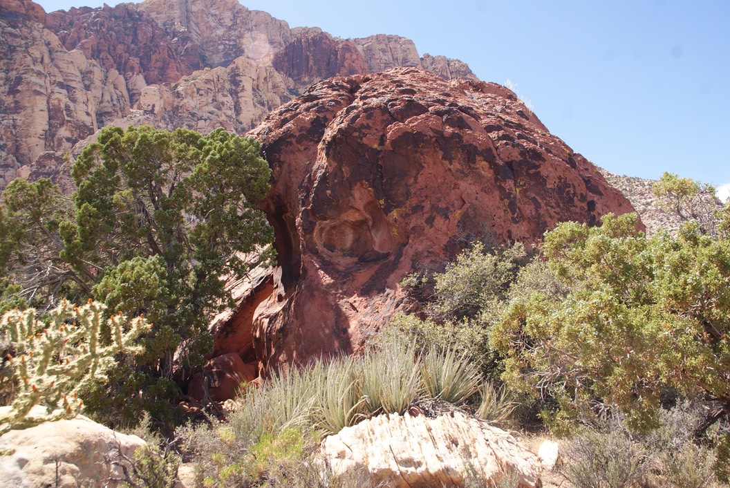
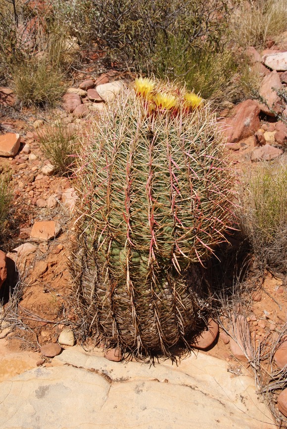
Then I continued the drive, until I got to my next recommended hike. The VC guy suggested I do a hike to Skull Rock…a must see. I found it only because there was a sign pointing to it. I walked around it a couple of times, but never really thought it looked like a skull…but the cacti were really pretty!
The temps were going up, & I was done in the park. I drove out the opposite way I drove in, down to a little town called Blue Diamond. On the way I was really, really, really hoping to spot some of the wild burros & horses they have in the area, left from the prospecting days. I never saw any & the town was a bust. But the good thing I discovered, was I could stay on this two lane road all the way south of Las Vegas…missing all of the traffic! YAY!
Tonight was a bust looking for camping. I started early enough & even headed down a crazy dirt road & found camping, but I wasn’t going to stay there..creepy creepy. Then I found a random parking lot…no, that wasn’t going to work either. I decided to drive & stay in a truck stop. Once in awhile, the camping thing just sucks…& tonight was one of those nights. I drove past dark to Kramer Junction…truly a junction for a gazillion tractor-trailers, a train & lots & lots of noise! I bought some jugs of water & pulled into the corner parking space & fell asleep. About an hour later, I saw flashing yellow lights a couple of parking spots over from me…it was a tow truck. But it wasn’t after me….it was towing another car in the parking lot. It took me a few paranoid moments to realize the owner of the car had called the tow truck…not the owners of the truck stop. I decided, if they wanted me gone, they would probably just bang on my window & tell me to leave. And with that thought, I fell asleep & stayed asleep until about 5:30am!
Day 12 6.1
I was glad to be leaving my ugly noisy camp spot & immediately turned onto CA 395! Yay! The whole point of coming on this trip was to discover the Eastern Sierra Nevada mountains along this highway. I stopped in the town of Ridgecrest & ate a big breakfast…my first out on this trip. Then a quick trip to Harbor Freight (just randomly passed it on the road) for an idea I had for camper (said project was tried, successful for one day, then it didn’t work….still thinking about how to make it happen!) I’d passed on the coffee at the local breakfast spot I’d eaten at, so I stopped at the Starbucks on my way out of town.
I’d read about Fossil Falls along 395…another volcanic rock area that had a lower & upper falls. However, even the sign/information board said these were ‘dry’ falls (just like some of the lakes I’ve passed). I did the short hike to the canyon, but without any water, I couldn’t tell where any of the falls should have been…upper or lower. But the walk was fine…it’s a beautiful morning!
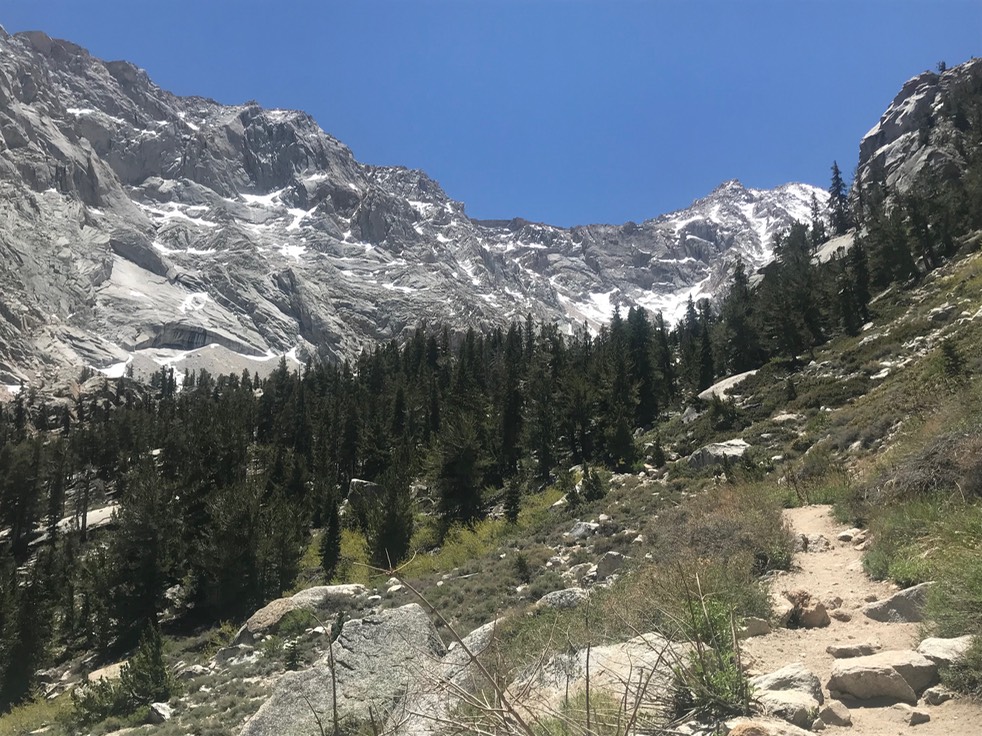
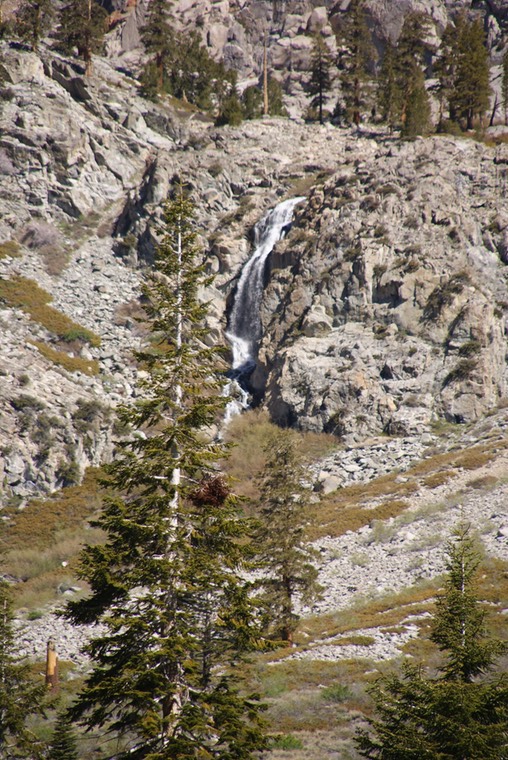
My next stop was the Ranger station/Visitors Center in Lone Pine. The woman was so helpful, telling me about all kinds of hiking in along my route & gave me maps & brochures galore. One hike that wasn’t even on my radar was up on top of the Whitney Portal road…a 6,000’ paved road that climbs up to the trail that climbers take to summit Mt. Whitney…the highest peak in the contiguous states. There was a 5 mile RT, 1,780’ hike I could do that didn’t require a permit. But she told me it gets really crowded on the weekends & I should go today (what day was it? I guess it’s Friday!) OK then, I was on my way. The hike took me up & up & up to Lone Pine Lake…super sweet & blue. Then I went a tad bit beyond my ‘boundary’ hoping to see a meadow I’d heard about, but ran out of steam & was a little concerned that if I tripped & broke something, I’d have to drag my body back to the permit boundary sign so I wouldn’t get in trouble.
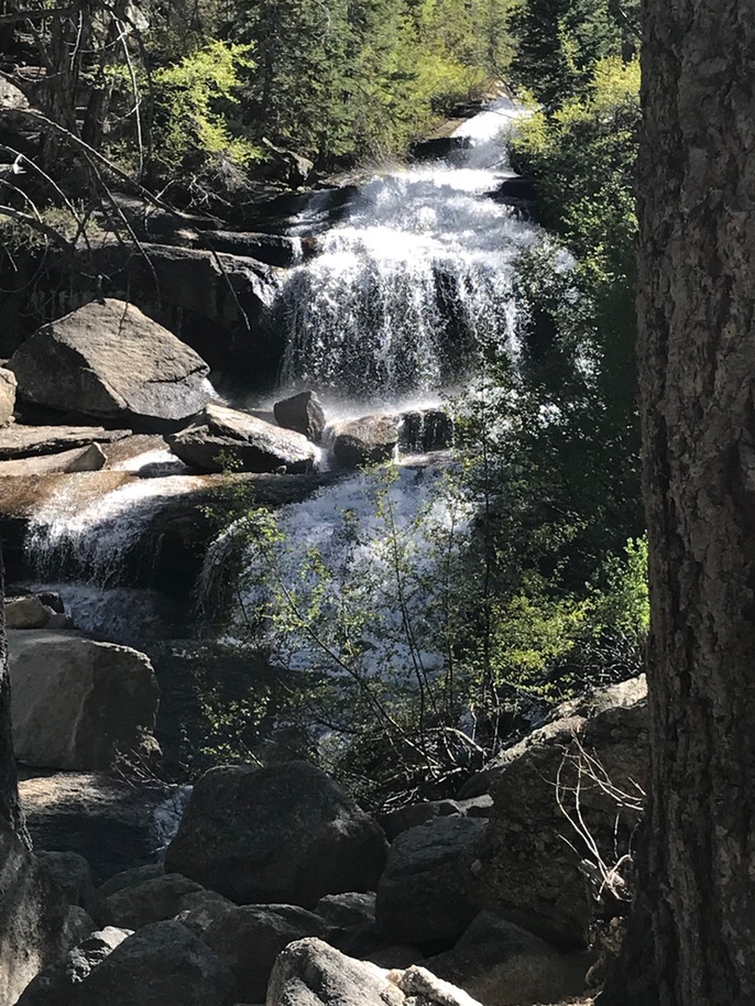
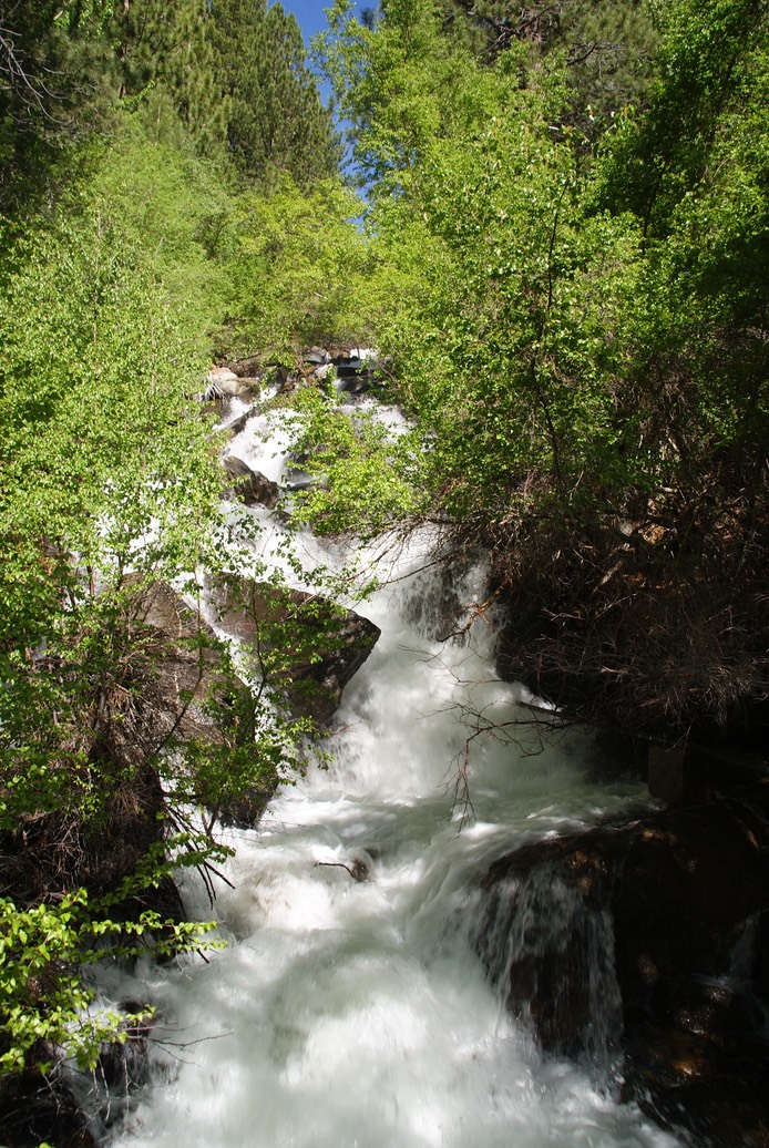
After my descent, I was really tired. I’d gone about 6 miles total, but I could feel all my previous hikes catching up with me. I know this because my left knee gets a tad bit cranky, suggesting I take a day off. There was a really pretty waterfall near the parking lot I stopped at too. (See rAnDoM for another pic.)
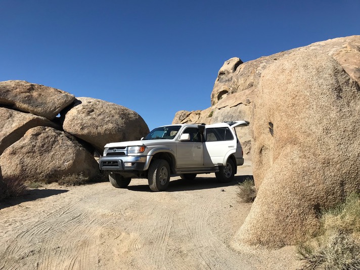
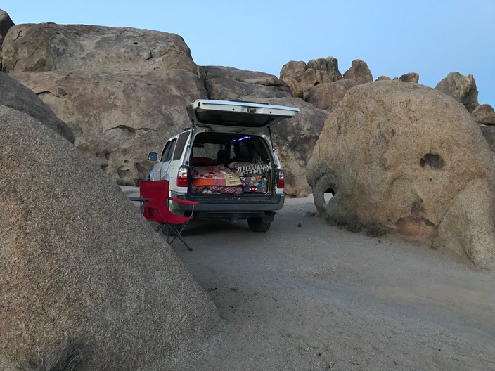
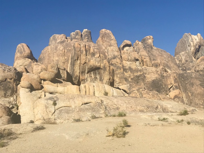
I’d heard about the Alabama Hills outside of Lone Pine as a really cool place to camp & it was awesome! There’s a road that runs through the middle of all these huge rocks called Movie Road. It references the many, many movies made here…mostly old famous westerns. I grabbed an awesome spot, high up on the rocks & right in between two giant ones. It was private & quiet & I loved it here! I was beat & tired. I ate something, drank a beer, looked at the night sky, then happily turned in for the night.
Day 13 6.2
My day was really rather uneventful & barely took a photograph. I decided to take a zero day & rest my body. I took my time in the morning, making coffee, reading & enjoying my lovely surroundings. Then I drove the few miles into Lone Pine, bought ice, downloaded a couple more books & got something to eat…not memorable food at all. There’s not much to eat here, but I’d read the Alabama Hills cafe was great…I beg to differ, but there were a lot of people there, so maybe someone really liked their meal.
Then I drove back to the same camp I’d been in the night before.
I think my spot was where one famous movie was made (maybe the Lone Ranger??; someone mentioned that) because once in awhile a car would drive up, people would pop out, climb up some of the rocks with a pamphlet in their hands, trying to match up the pictures…it was kind of funny. Once back, I just read & read. Then I started hearing music. I’d seen quite a bit of activity down on the road in front of me, but only paid a tiny bit of attention. Then about 7:45pm, a couple drove their car up to my camp, asked if they could park it there for the evening. They were sneaking around through the rocks to hear a Frank Sinatra type concert saving the $80 per ticket price. I didn’t care at all. The band started at 8 & finished around 9:30..”Fly Me to the Moon”; “The Lady is a Tramp”, “New York New York” & on & on. I didn’t even have to leave my red camp chair to hear the music…it was kind of nice.
Day 14 6.3
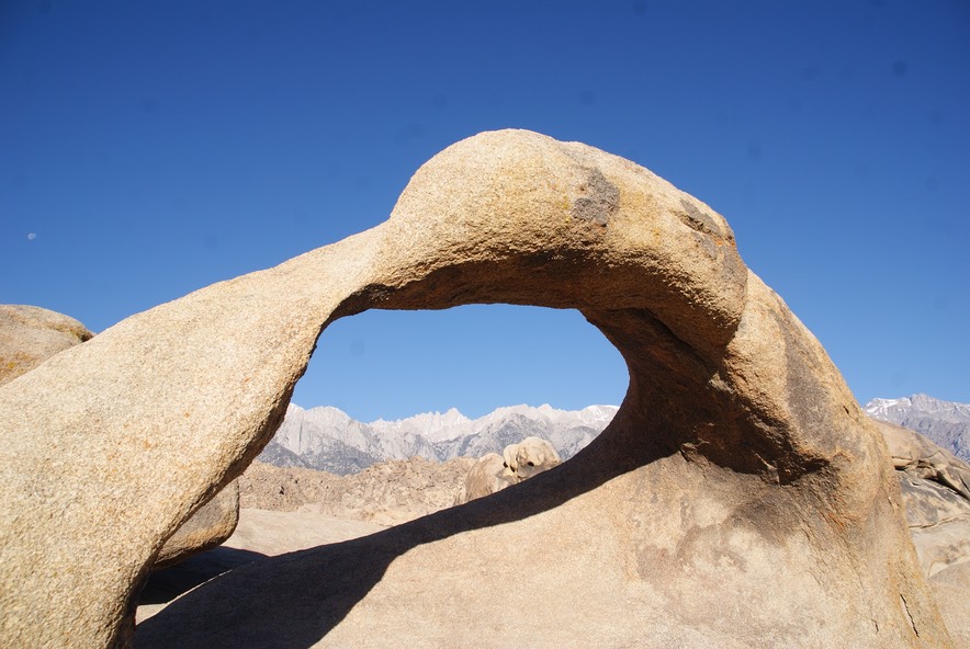
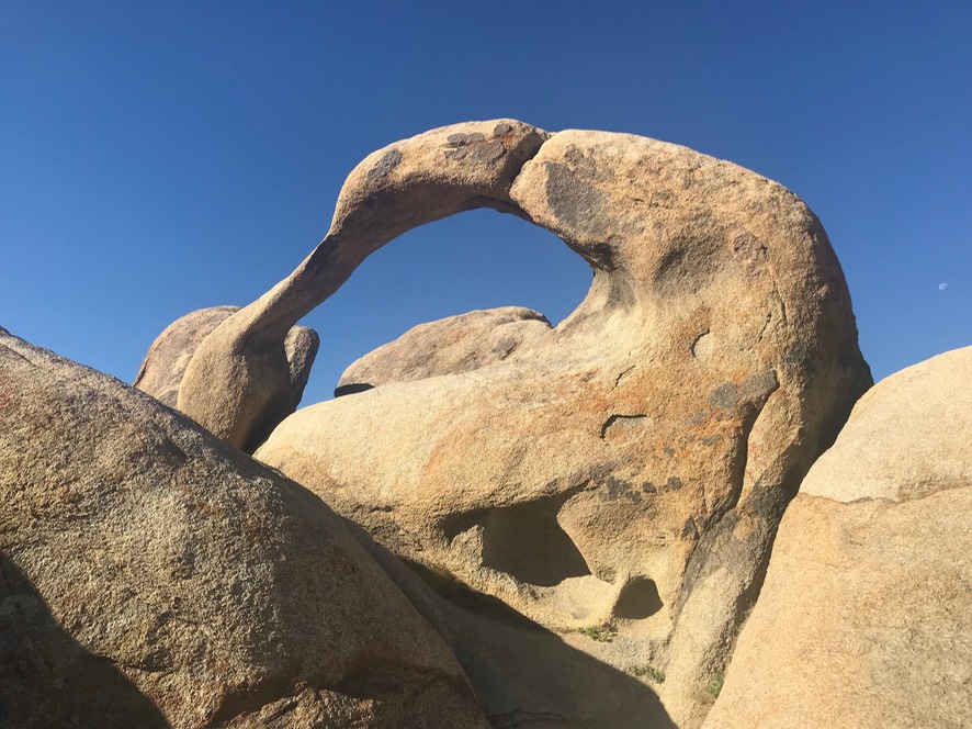
I was feeling good this morning & woke up about 6am. Had a nice long coffee chat with Danny…he’s been at the lake this weekend getting everything ready for his mom’s summer visitors. About a mile down from my campsite is the Mobius Arch along Movie Road, so I started my morning hike there. It was a pretty short trail, up & down, over the rocks & through the sand, but it was an awesome arch!
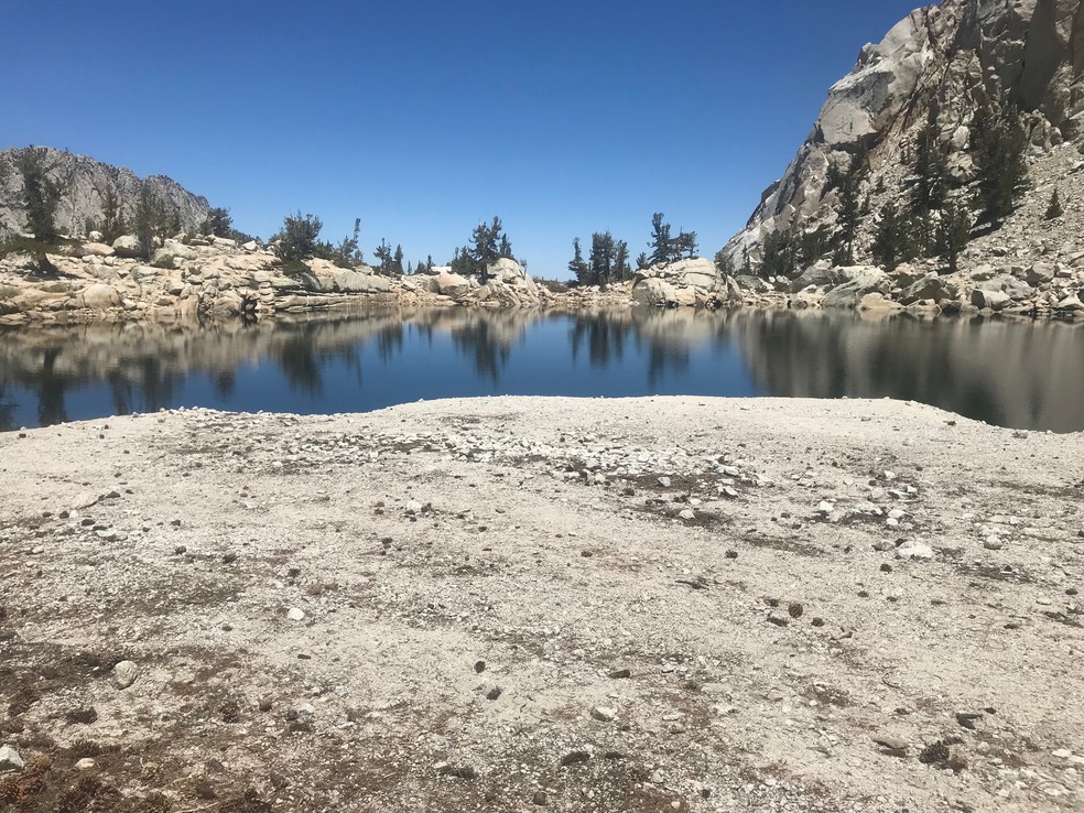
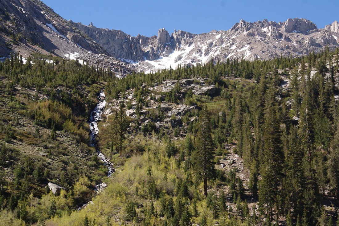
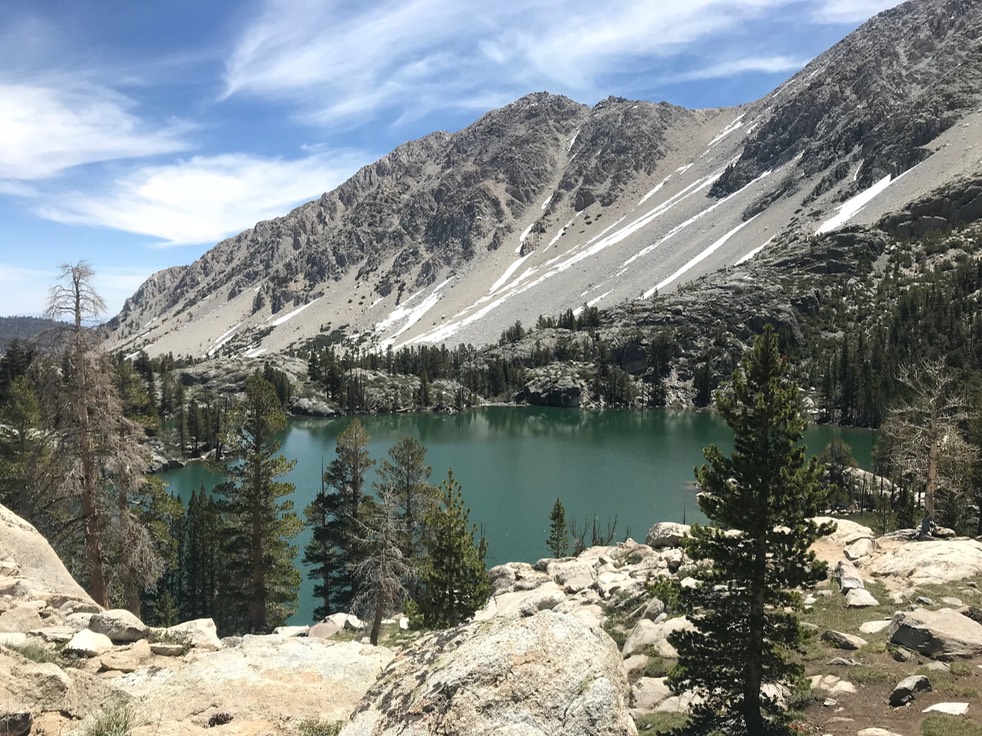
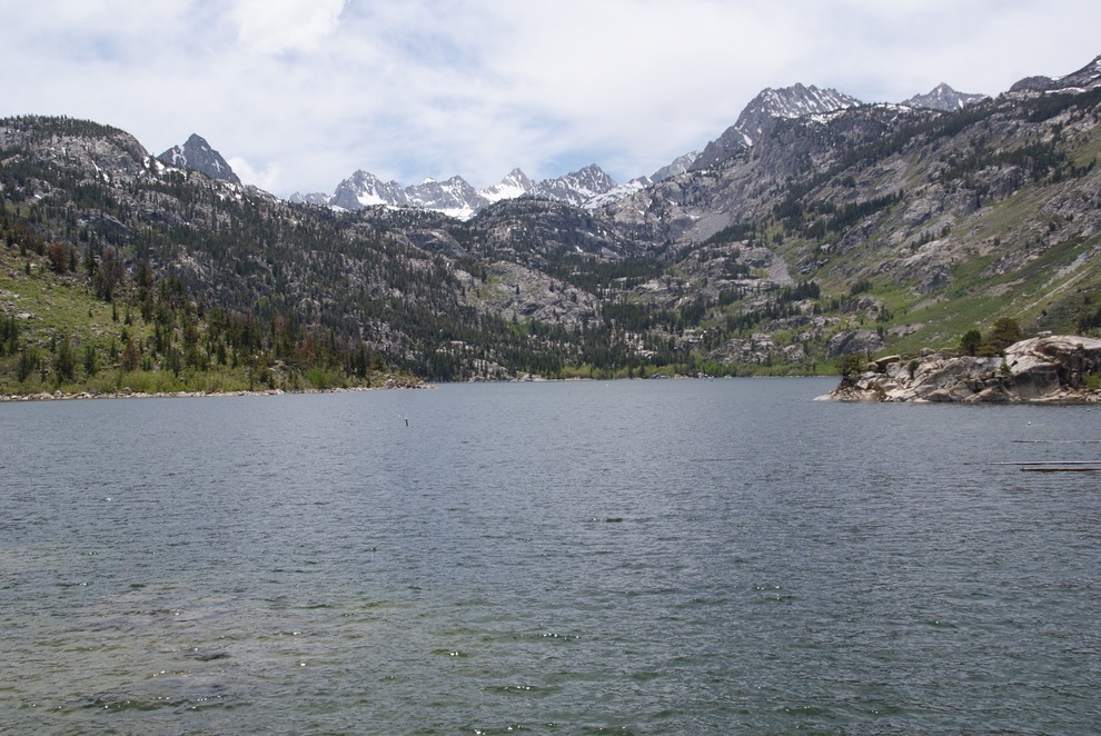
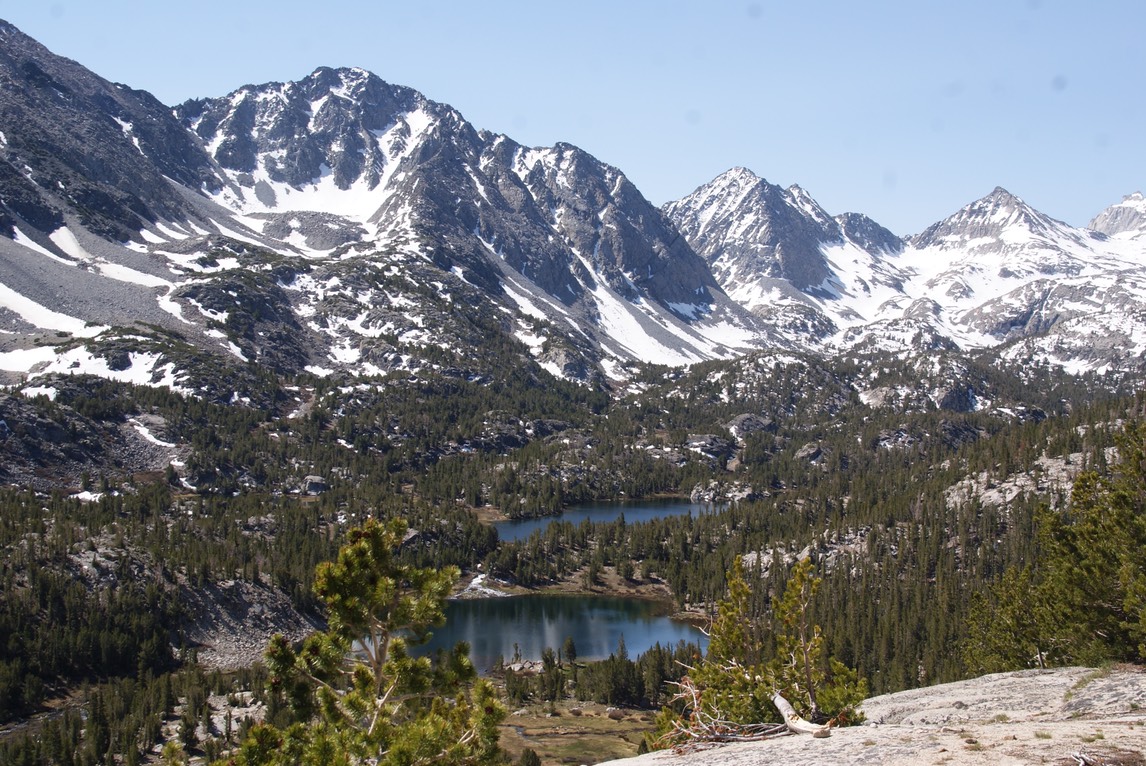
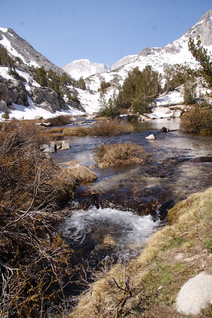
Then I drove up Onion Valley road to hike up to three mountain lakes. The trail up was about 1,750’ & 5.5 miles RT. Lots of waterfalls!
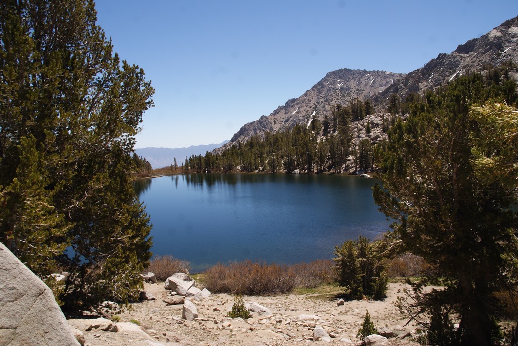
This is Gilbert Lake…the largest (I think).
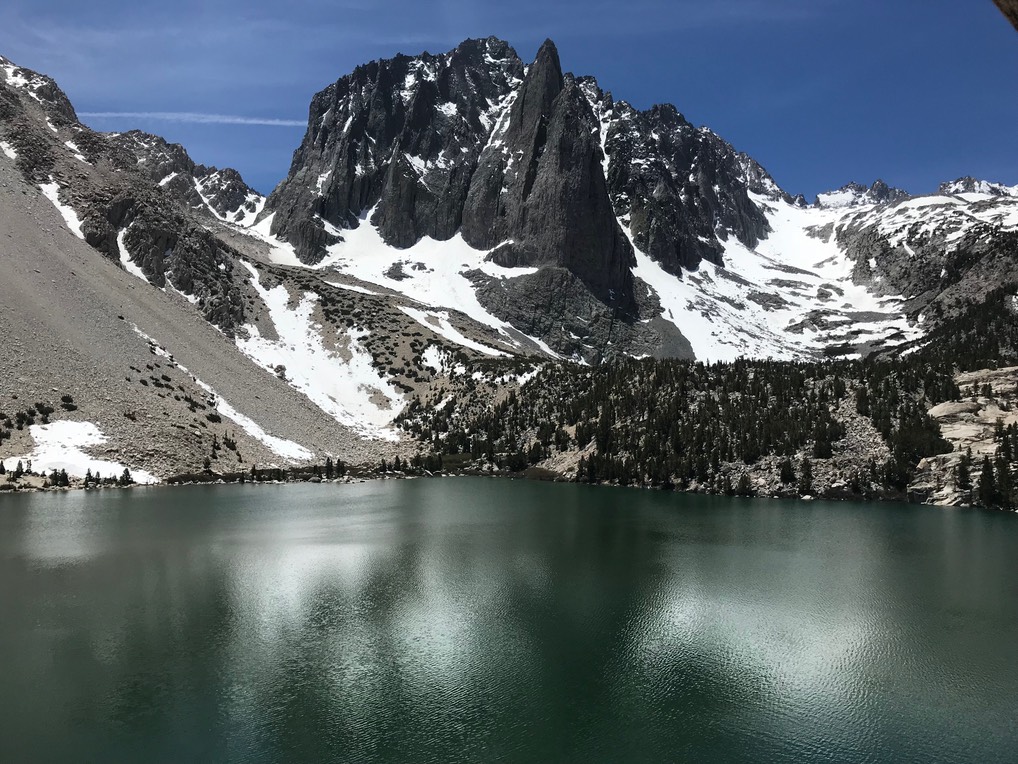
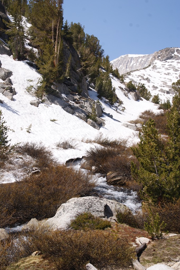
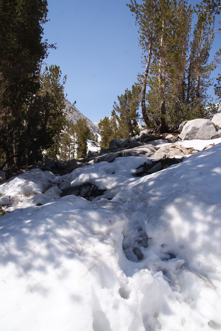
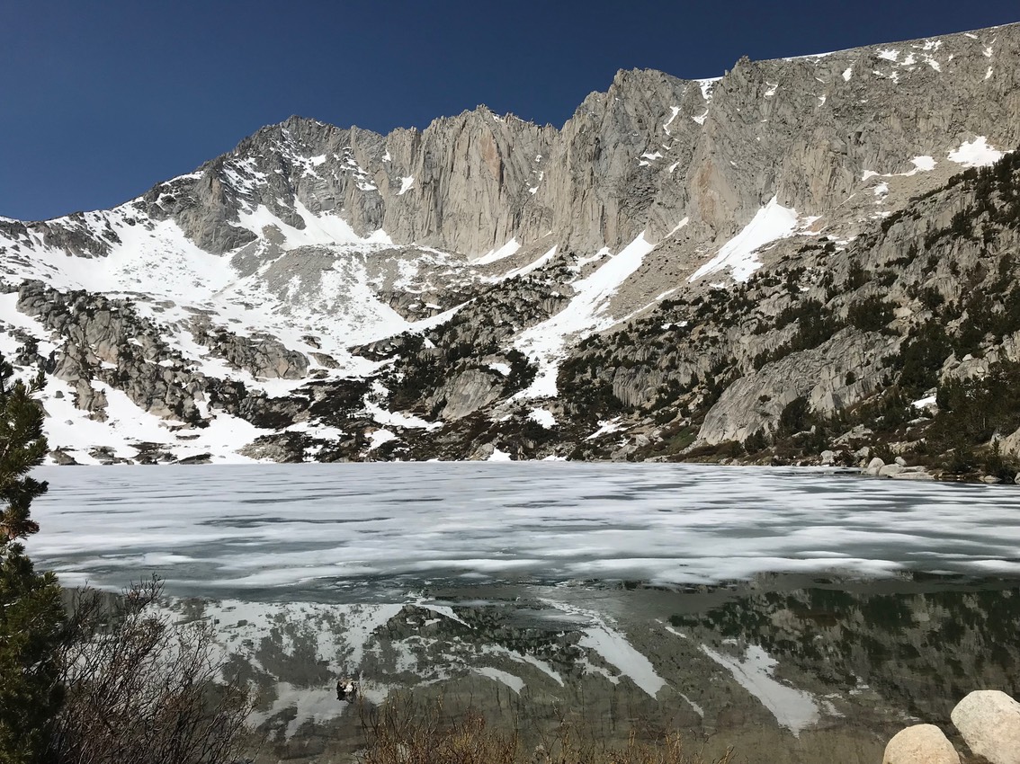
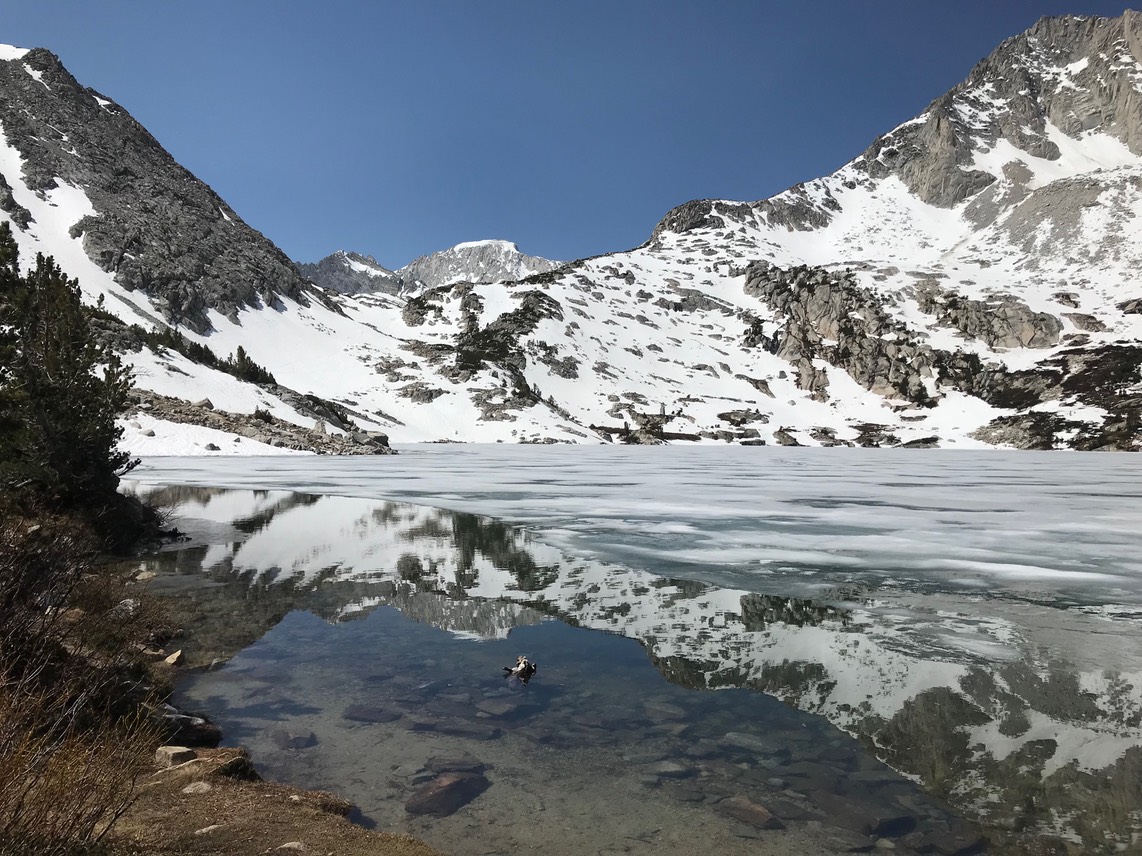
Flower Lake was the third & highest lake I hiked to…beyond that, as you can see, the trail is snow covered. There were tons of backpackers coming down & going up. I think a lot of the ones coming down had just stayed at the lake over the weekend. But this trail hooks up to Kearsage Pass which is along the PCT/JMT trails, so I think alot of the backpackers were hiking those trails.
After my hike down, I looked for camping. It was hot, but I found a super sweet spot in Onion Valley under some trees & right next to a beautiful little stream with crystal clear water!
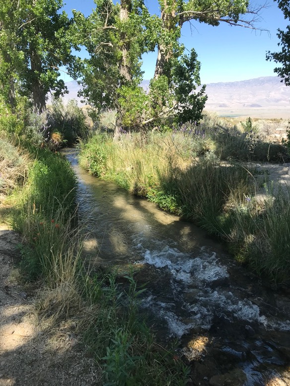
I decided to take a quick bath (sans soap) in the stream & felt pretty clean after—changed into clean clothes, poured myself an awesome stout & read for the evening taking lots of time out to look at my wonderful view.
Day 15 6.4
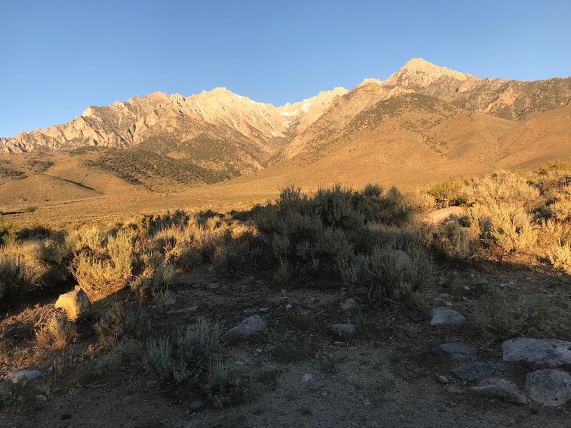
I slept great & woke up to this sunrise view!
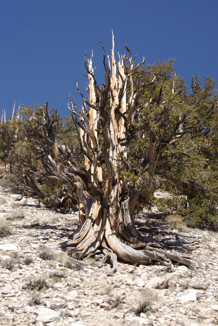
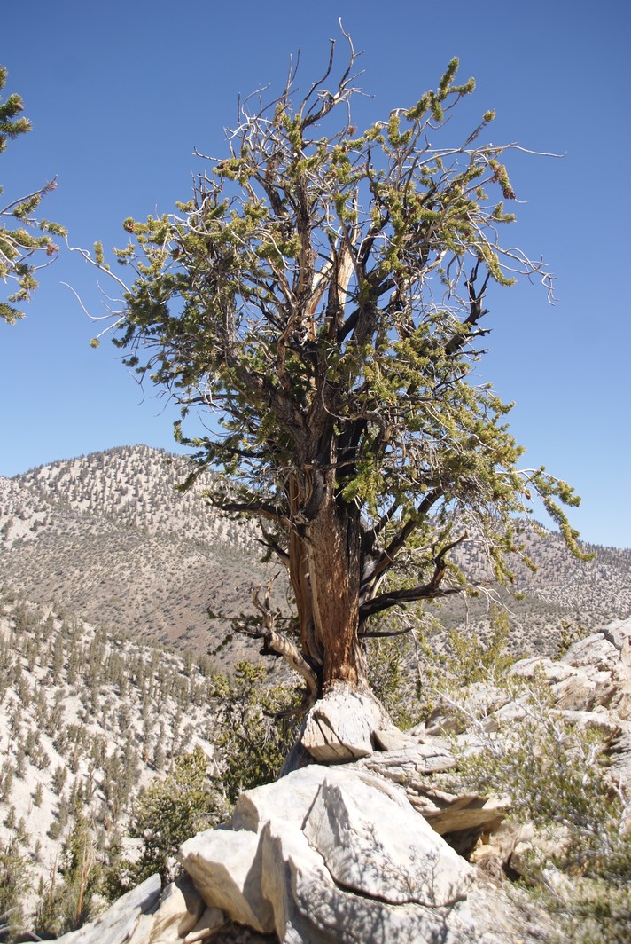
I did my usual morning stuff, then took off. I veered off of CA 395 & headed east on 168 toward the Ancient Bristlecone scenic highway. It’s narrow & curvy & the mountains come right down to the road. It’s 13 miles up to the Visitors Center. They weren’t open yet, so I took off on the Methuselah trail…named after the oldest tree in the Schulman Grove…she’s 4,600 years old! The trail goes up & down & all around you are Bristlecone Pine trees…no other trees can live in these harsh conditions. The trail starts out at 10,000’…usually above treeline on most mountains. The whole trail was 4-4.5 miles but about mile 2.5 a little trip magic happened. A young woman hiking alone was photographing these amazing trees, & I stopped behind her on the trail. We got to chatting. Wow! She is a super bad ass hiking woman!! Her name is Sarah & she’s from Louisianna. She’s been heading south, as I’m heading north. So I asked her about a hike I’d been toying with doing tomorrow. She’d done it yesterday & way more of it than I’d thought to do. Then she told me she’d just finished backpacking the Grand Canyon…Rim to Rim to Rim!!! Holy Crap! I can’t take any advice from her…she’s at a way different level of hiking than I am—like Wonder Woman level. But we hiked the last of today’s trail together & had such a wonderful visit…talking about trips, solo travel, camping, social media sites we both use, etc. We parted at the now-opened VC as I had a list of Bristlecone Pine Tree questions to ask.
The young man in the center wasn’t a ranger, but works for the non-profit group Eastern Sierra Interpretive Center. He politely & expertly answered my few questions & even took me outside to show me the difference in a few hundred year old tree & a 3,200 year old tree. Using a microscope, he also showed me how they date live trees. It’s all so fascinating!
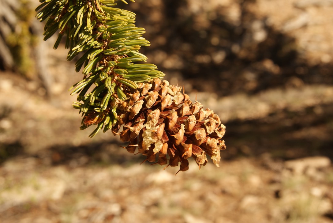
They call this shape a foxtail branch.
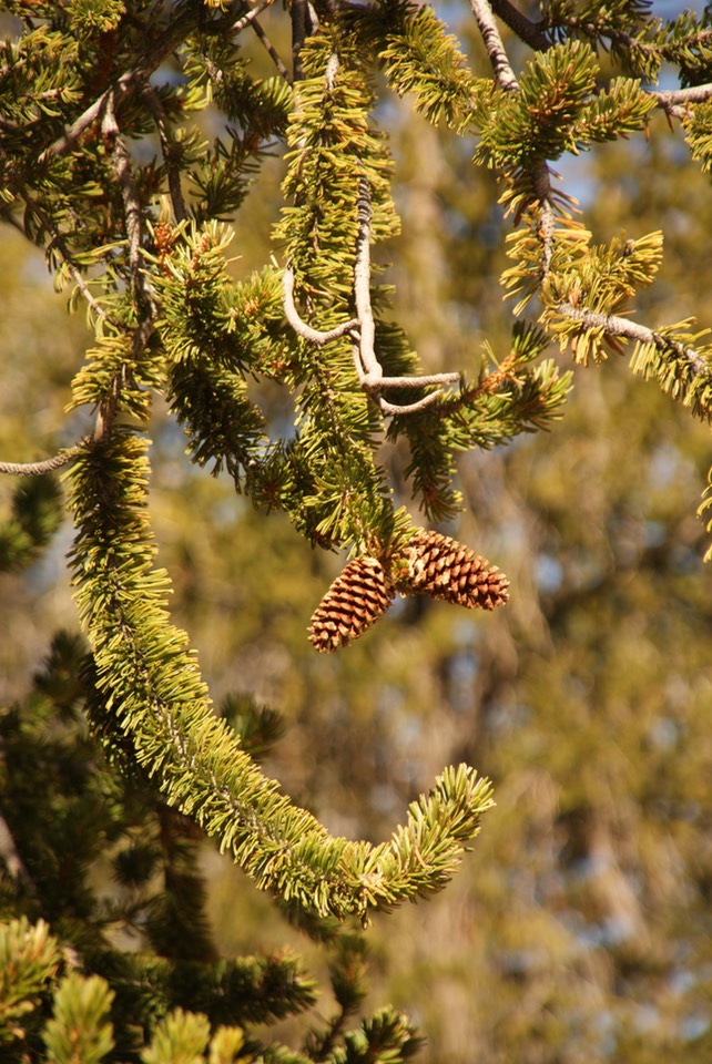
The cones have these spiky things on them…that’s why the tree is called a Bristlecone.
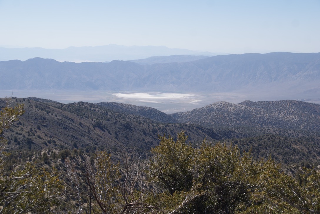
A dry lake looking towards Death Valley.
There are only 5 states that have these kind of unique pine trees—New Mexico, Arizona, Colorado, Nevada & California. This is a huge grove…it was a spectacular hike & I loved learning about these ancient special trees!
The guy & I had visited for quite awhile, when he asked me where I was from. He laughed when I said Lawrence & he said he was from Topeka. So, we had another discussion as he told me how he made his way out here, got a job last year, learned everything he could about the Bristlecone Pine tree. They get a bunch of snow up here in the winters, so the VC is closed during the fall & winter & some of spring. He has lots of other jobs he does working for this non-profit & they all sounded really fun. I congratulated him on getting to leave such a yucky state & wished him well in this beautiful state of California!
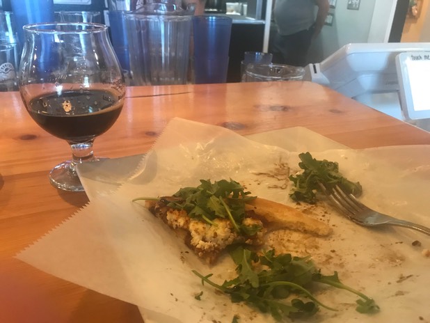
I checked out a campground I’d heard about near the VC; it was a great campground & only $10, but it was only 1:00….too early to set up camp for me. So, I drove down the curvy road & on up the highway to Bishop…the biggest town so far along the 395. I’ve heard a lot about Bishop, but it wasn’t what I expected…it’s still a pretty small town. It was 95 degrees & felt like 150 in the sun. After a couple of phone calls (I’ve had super sporadic service) I headed for the one & only brewery in town called Mountain Rambler. They had an imperial stout I wanted to try & I also grabbed some lunch. The food & the beer was wonderful! (The remnants of my goat cheese & carmelized onion flatbread!)
Now it was time to look for camp. I was still unsure if I was going to do the hikes up Glacier Lodge road tomorrow, but I was going to try to find camping somewhere along the road. There are three NFS campgrounds, but they were expensive & I still don’t know my plans tomorrow. When I’d driven up the road to the trailhead earlier today, I just plain didn’t want to hike that hike. All evening long I’ve tried to figure out why, with no answer. Once I set up camp & went to move my backpack, I realized it was wet…along with my quilt, my sleeping bag & my bed. I’ve been having trouble with my camelbak & wondered if it had a small leak. So, I messed with that awhile. It was a warm night so I threw the quilt & the bag out to dry & just scooted over a bit to avoid the wet spot in my bed. We’ll see if a good nights damp sleep gives me any answers tomorrow about the hike.
Day 16 6.5
Today was the day I was planning on hiking Big Pine Lakes—#1, #2, & #3…it goes all the way to 7 plus Black Lake but that’s about a 16 mile hike & some of it in snow. This had been the strangest thought process to make this decision…first I read about—it sounded ok…but then I was indecisive. The day before I’d met Sarah on the Ancient Bristlecone Pine trail & she’d hiked the whole giant hard loop the day before. So, I decided then I would definitely hike to #3. Last night I drove the long uphill road looking for camping & got to the trailhead…my brain said “no don’t hike it!’. It wasn’t fear or “I’m going to die on this trail” message, but just indecisiveness. I told Danny I wasn’t going to do it & picked out another hike 20 miles away but I was planning on coming back to Big Pine tonight (I don’t like retracing my drives). I researched the Big Pine Lake trail again last night…well, I never did figure the “why", but this morning when I woke up, I’d decided to hike it. Maybe part of my thought process was that the elevation was 2,800+ feet & 11 miles RT. I’ve done that & more before…but was that the problem? That I thought I couldn’t do it? Guess I didn’t need to answer the question, because early in the morning, I had my boots on that trail & was headed up & up & up.
My sleep stuff had all dried by morning, including my pack. But when I went to fill my camelbak with water, my pack was all wet again. I checked & rechecked everything finding a couple of things wrong…righted them & put it on my back. I figured after awhile of climbing all the elevation in the sun, I wouldn’t be able to tell what was water-wet or sweat-wet.
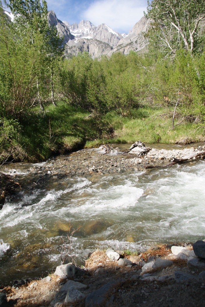
The trail follows the raging whitewater creek, so it’s noisy but beautiful (I was just hoping I wouldn’t have to cross it at anytime!).
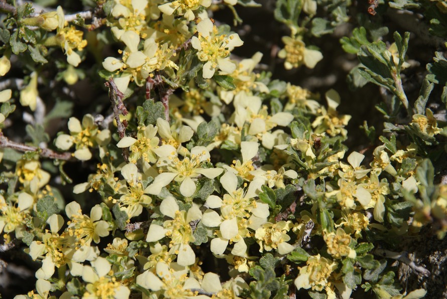
wildflowers along the trail!
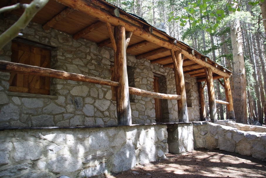
About 2.5 miles up the steep trail, you come to this beautiful big boarded up cabin. History says that it was built back in the late 30’s by actor Lon Chaney…the front porch was awesome facing this wonderful clear water creek.
The hike didn’t seem as hard as the elevation would lead you to believe, but after 3.5 hours, I reached Lake #1.
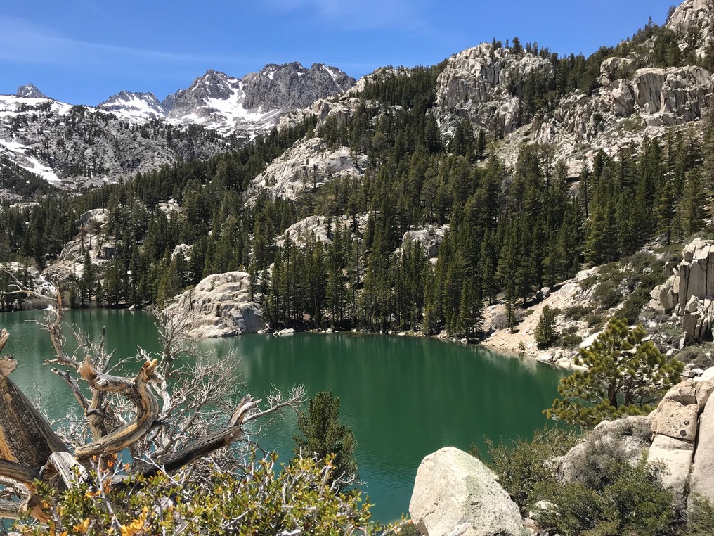
I took a break & ate some tuna (yuck!) & took in the lovely view! About 15 minutes later & some more climbing & I was at Lake #2…which turned out to be my favorite!
The above photo doesn’t show the bright turquoise water…it was really beautiful! The rock formation in the back is called Temple Crags. I continued up the trail arriving at Lake #3 about 40 minutes later.
I was done climbing for the day. I went back to #2 & took a break for about 20 minutes. It’s over 10,000’ here, but the sun kept the air temp just perfect. The hike down was nice…it’s always nice to be going down & this trail wasn’t too brutal on the knees. I stopped to eat & drink—I’d been monitoring my water usage from the start…hoping the camelbak didn’t leak (it didn’t) but I was drinking water like crazy & I didn’t want to run out— & sat on Lon’s porch & enjoyed the peace, quiet & getting off my feet.
Once I was down to the 4Runner, I changed into my Chacos & poured me some ice cold cucumber jalapeño lemonade…I actually drank two glasses. I had been on the trail for 6.5 hours. Once back in Big Pine, I went to the grocery store…it was tiny & didn’t have much. I bought some flour tortillas & ice & went to camp to cook burritos. ICKY! Don’t know what happened, but they didn’t re-hydrate. So, my cheesy bean burrito was rather crunchy. I was still hungry, but didn’t want to repeat that mess again, so I opened a beer, put my super tired feet up & read until dark. Then I climbed in Camper (my 4Runner) & read until late about midnight.
Day 17 6.6
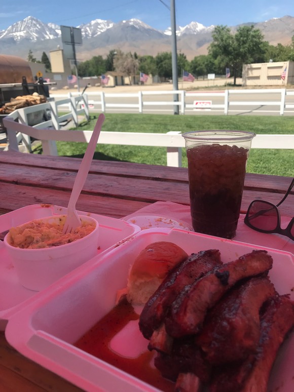
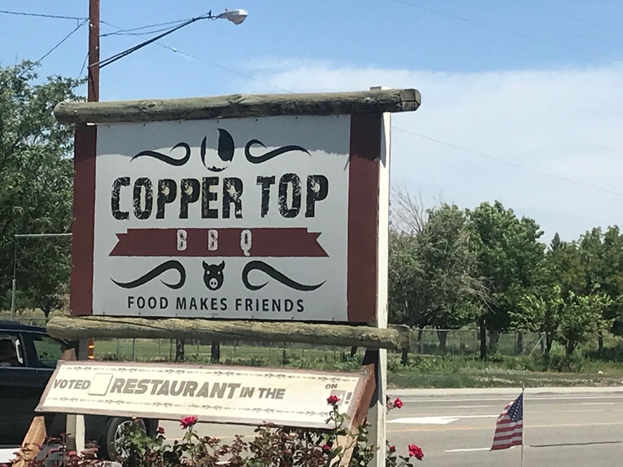
I was up & out of camp early & down in the town park. I read awhile then made coffee then went for a shower at one of the two gas stations in Big Pine. It was clean, not the worst but not the best shower either. I was in & out of there super fast, but it did feel good (until the hot water became not so hot). I caught up on a few phone calls, then around 11am I went to the Copper Top BBQ place for an early but much anticipated lunch. You remember when I thought I was crazy that I thought the farm to table high end restaurant in Escalante was BBQ? This must have been the place that was stuck in my head. Supposedly (because who really can measure these things) this is a super famous highly ranked tiny little BBQ joint. I ordered the ribs & potatoes salad. The potato salas wasn’t so good (I’m picky about my PS) but the ribs were OMG amazing! The glaze/sauce on the ribs was perfect & they were meaty & yummy!
Then I drove to Bishop to the VC. While getting another hundred brochures I asked them about Sky Rock. A good friend of mine told me there is this super special petroglyph called Sky Rock out of Bishop & to please not post it’s location, IF I found it. I searched & searched before my trip…it’s the biggest damn secret I’ve ever come across while doing travel research. And, so I asked the chatty guy in the VC who’d been so helpful, marking up hike after hike with his highlighter & giving me tips on how to drive on mountain roads (eye roll). At the end of our visiting I asked him about Sky Rock & could he tell me how to get there. He got a stern look on his face, closed his book shut & said “I don’t know anything about that. I can’t talk about it.”. Then he turned around & walked away. OOOOKKKK.
I headed towards the mountains to Lake Sabrina (which the VC guy corrected my pronunciation…it’s not Sabrina like Bewitched..it’s Sa-BRINE-ugh…like what you soak pickles in). I made sure I didn’t have to say the name the rest of the day for fear of being corrected again. I was hoping to rent a kayak for the afternoon. Lake Sa-BRINE-ugh allows fishing boats so there were some fishing boats in the water. The whole area was a little junked up between the marina, the snack bar but mostly all the crap around those two things…trailers, old boats, junk, etc. The only kayak they had to rent was a tandem. The wind was blowing too much for a single kayak, much less paddling an empty second seat & longer boat, so I passed.
On my way up to Lake Sa-BRINE-ugh I had pulled off the road for a few miles into an area called the Buttermilk…a world class bouldering spot. There are tons of climbing & bouldering areas here. It was supposed to have some dispersed camping & it was cool because it was all these big rocks, but it was also open in the hot sun & really really dusty. So, on my way back down from the lake, it was time to look for tonight’s camp site. The guy at the Bishop VC told me a pretty drive down a canyon road called Pine Creek which also had good bouldering (I wonder if he thought I was a climber?). So, I headed north out of Bishop a few miles, found the road & drove the 6 miles to the end. The canyon walls are huge & the sides are about 1/4 mile apart with a medium sized creek running along one side. It was super beautiful! I turned around at the end, & drove back to find a spot for the night. This was NF land, so I knew I could boondock here.
So, to veer off the path for a moment, here are my list of fears when solo traveling..in order:
1. Being attacked by a mountain lion or Grizzly bear (not other bears)…it’s a tie;
2. Being struck by lightening;
3. Raging huge water crossings (this is the thing that I encounter the most); & newly added to my list this year,
4. Tick diseases (this is more probable than #1 & #2).
Now back on topic: But not on my list is fear of the dark. I’m not 2. Last night in this wonderful beautiful camp, with no one—NO ONE around—I was enjoying reading. The wind would pick up loud & fierce every now & then & the temp was dropping. When the wind was still, it was deadly quiet. I was huddled in my Rumple blanket & sweater sitting outside reading until the wind started knocking everything on my table off to the ground. So, I put the table & chair away & I moved into the car. I was so involved in my book, before I knew it the sun had set & it was dark. I mean really super black dark. LIKE CAVE DARK. I looked outside & couldn’t see anything…no shadows, no sky, no stars, no canyon walls... DARK DARK DARK. Hmmm…I was a tiny bit scared. This is when I start the long & crazy discussion with myself. I go back & forth & try to figure out why was I getting nervous? It was just DARK…really really black outside. There was no cell service here, so no late night talking to Danny (I’m on Pacific time zone anyway) or trolling FB or IG for distraction. This went on for about an hour. I was not going to let this stupid feeling make me move to where? in the middle of the night. I had my booklight on…then I turned on my LUCI lantern & lit up the inside of the 4Runner. But about 11, I was ready to turn all the lights out & go to sleep. So, the lights went off. Now it was DARK inside & outside. For a couple of hours I laid there, not really scared anymore, but not going to sleep either; trying to still my crazy mind. I eventually drifted off & when I woke to pee in the middle of the night, the stars were shining bright above me…a million beautiful, bright, twinkling awesome stars!
Day 18 6.7
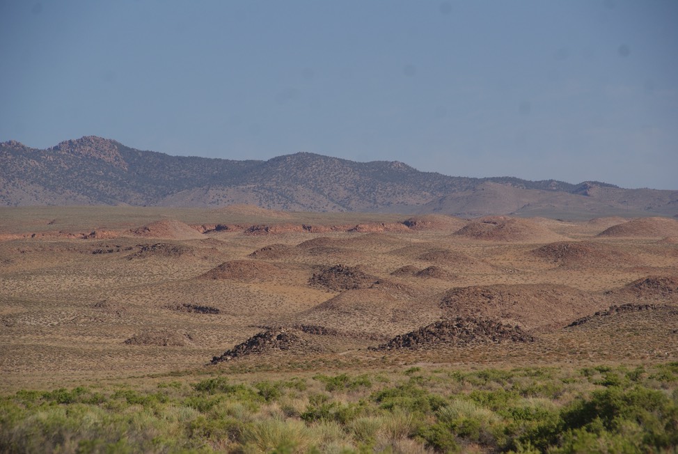
The sunrise was beautiful on the canyon walls & last nights crazy was in the past. I drove back into Bishop & went to Looney Beans for a cup of coffee, then RE-researched Sky Rock again. It sits somewhere in the Volcanic Tablelands just east of Bishop. It was only about 7:30am, so I decided to drive out there. The guy at Ancient Bristlecone Pine trail, told me there were 3 other cool Petroglyphs along this road, but they weren’t marked either. Maybe I’d see another car or two parked along the road that would give me a hint? It was a beautiful morning & I enjoyed the drive…but never found one petroglyph or Sky Rock or 13 Moons. Such is life….you don’t always get to see everything. (Below: Volcanic Tablelands)
I drove back in & through Bishop back on CA395 heading north. I’d read about a hike called Chickenfoot Lake—rated easy; 5 miles RT with only 500’ elevation gain. It started up in Rock Creek Rec Area. I found the trailhead with a few other cars already parked. I ate my 2 pieces of celery with today’s filling—hummus & finished my coffee. It was colder up there, so I changed into a long sleeve shirt & pants, got everything together, including my dry & not-leaking camelbak & hit the trail. It started climbing & after a bit, I came to a fork in the trail…two signs pointing two different ways to two different passes. No mention of my lake. I took the upper trail because it looked like it would be prettier. About a mile & 1/2 later I came upon three men a little older than me hiking the same trail. I asked them if I was on the trail to Chickenfoot Lake?
Oooppsie & Wowwie!
He told me I was not…& pointed down below to a view of several lakes. So, I asked him which trail was I on? He said Ruby Lake. We talked trail details for a bit…they were so nice & I decided to stay on this trail. After another mile or so, they pulled off the trail & took a break. They told me what they thought the trail details were, so I took off. The view over the lakes below were wonderful! (Chicken foot is the farthest one back.)
The trail kept climbing but it all felt great. I soon heard gushing water above me, so I knew the lake wasn’t far. I came to a fork in the trail…one sign pointing up to Mono Pass, the other to Ruby Lake. The snow was not all melted out up here & there was a little bit of thigh deep snow on the trail, but it had already been post holed & was soft.
And then I turned the corner…& one of the most magnificent high mountain lakes I’ve ever seen was glistening in the sun…still most of it iced in from winter. It had huge towering gray monoliths behind it. I was all alone here & stayed for about 20 minutes….it was spectacular!
As I was headed down from the lake, the three men had just arrived. We visited for a bit & thanked them over & over for telling me about this hike. Earlier on this trail, I had started to realize that I’d climbed way more than 500’ & if I hadn’t run into those guys, I would have probably turned around. Then I would have missed my favorite lake -so far- in the Eastern Sierra Nevada mountains. Wow. I love this scenery!
I smiled all the way back to the 4Runner, changed into my hiking skirt, sandals & a t-shirt & took off down to my next stop.
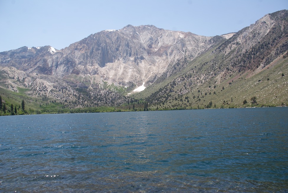
Everyone told me about Convict Lake. It’s heavily used by fisherman & wedding planners. The campgrounds were big & crowded. I drove up there & got out & looked around but soon left. It was pretty, but I really couldn’t stay. (See rAnDoM under Signs)
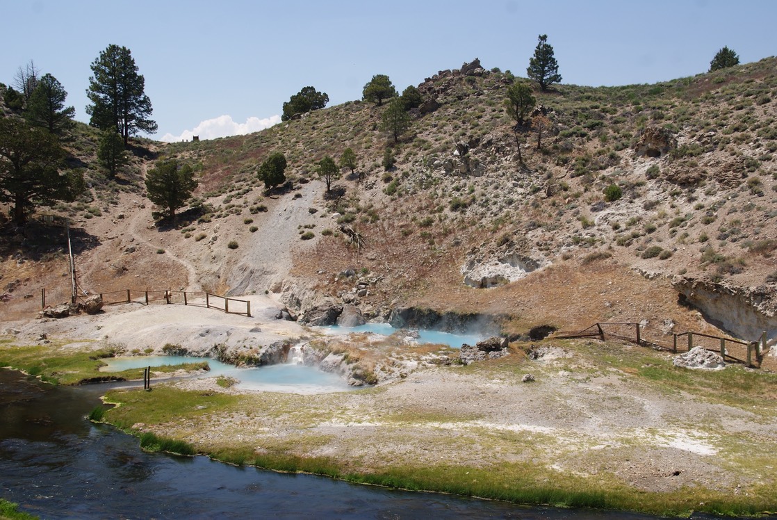
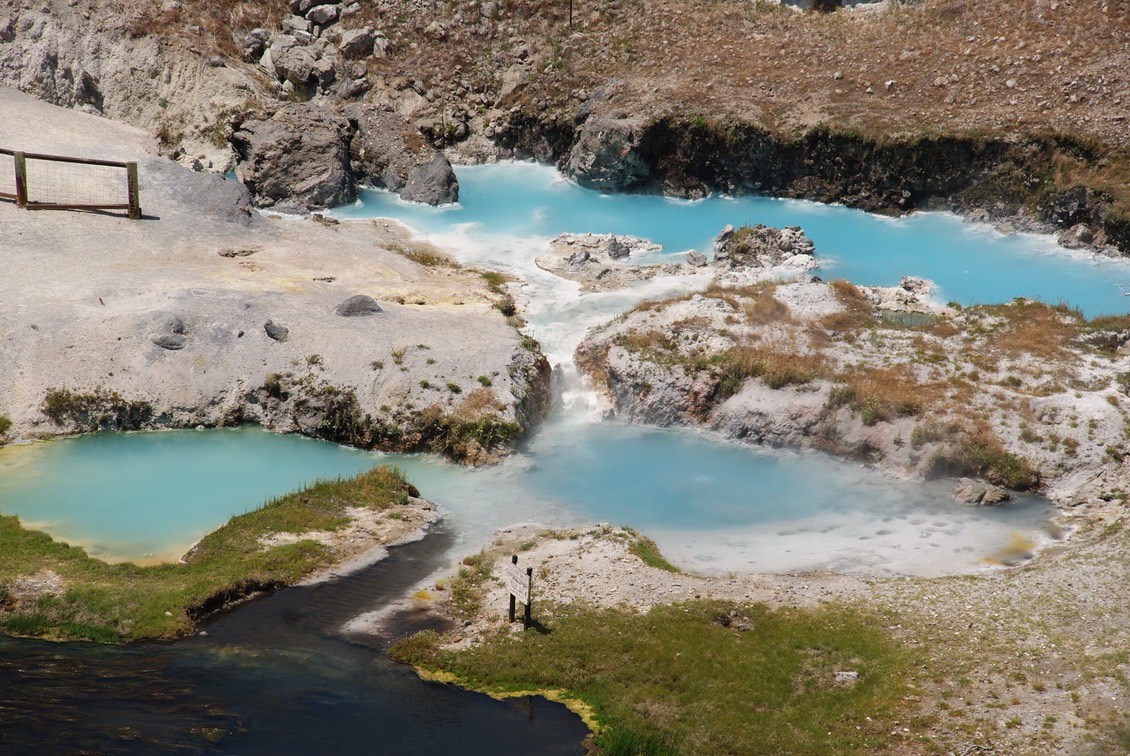
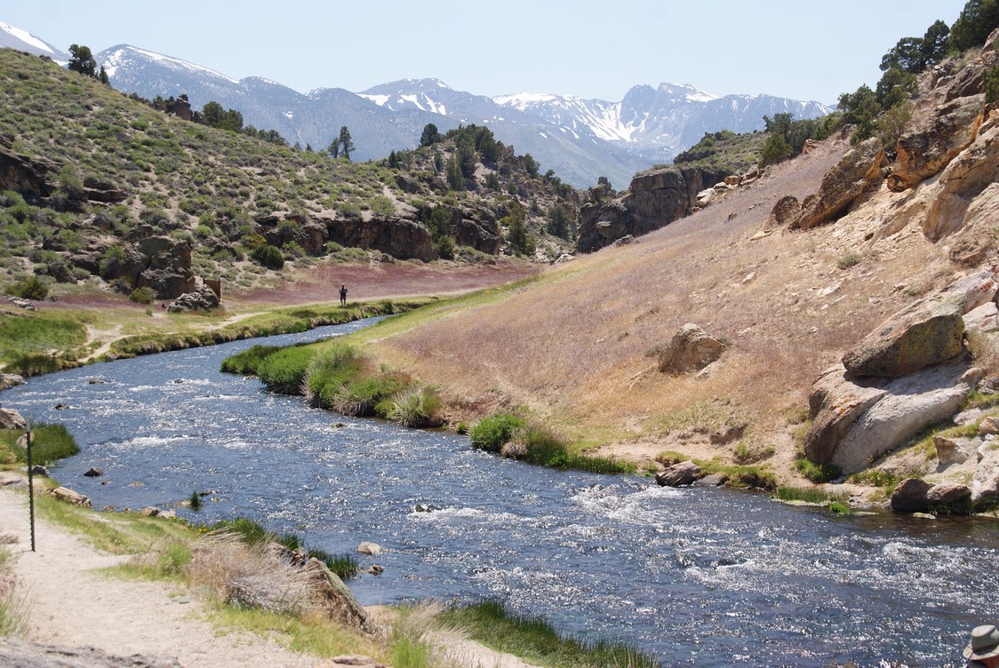
Next I drove to the Hot Creek Geological Site. With hot springs (too hot to soak in) & geological vents like Yellowstone…only not really anything like that in my opinion. But, I hiked down to the river & looked it all over. It was pretty cool. There are a ton of hot springs in this area, that you can soak in…commercial & natural. But, it’s been so hot in the afternoon & they all seem to be in the wide open. At night I’m usually in camp…so I must be doing something wrong to not be able to take advantage of these natural hot tubs.
I headed into Mammoth Lakes & stopped by the VC. I spoke with a super nice woman from the Eastern Sierra Nevada Interpretive Association (same as the guy from Topeka). She was very helpful, telling me exactly where I could find tons of camping spots & suggesting some hikes. This is the difference when you ask a Visitors Center person paid by the Chamber of Commerce—hotels & restaurants- & someone who is just there to give out info. Chamber paid people push their hotels, because thats where their salary comes from. I’m loving this Easter Sierra Nevada Interpretive Association…I’d be so good at a job like that!
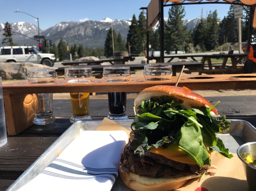
I left with more highlighted papers & drove to the Mammoth Brewing Company. I got a super delicious burger (yes, to everyone who is looking at that picture, I did eat it all) & 3 sample beers & a sample of an Imperial Root Beer…that’s funny.
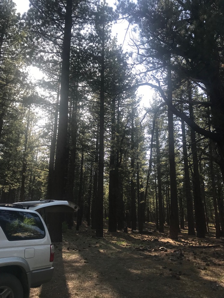
I waited to leave town until I could talk to Danny & catch up with him. Then I took off to easily find a spot to camp in tonight. It’s a beautiful forested spot & as I work on the website I can hear an owl hooting in the distance. I think I’m going to sleep super great tonight!