Day 1 5.21
It takes awhile to get out of Kansas. My destination today was 718 miles to a tiny town along I-70 called Dotsero. After 11 hours of listening to an audio book, several podcasts & mostly my 12 hour playlist, I found a dispersed campsite on BLM land called Deep Creek, read a book then settled in the for night. It’s funny how doing nothing all day but sitting on your butt in the car can make you sleepy.
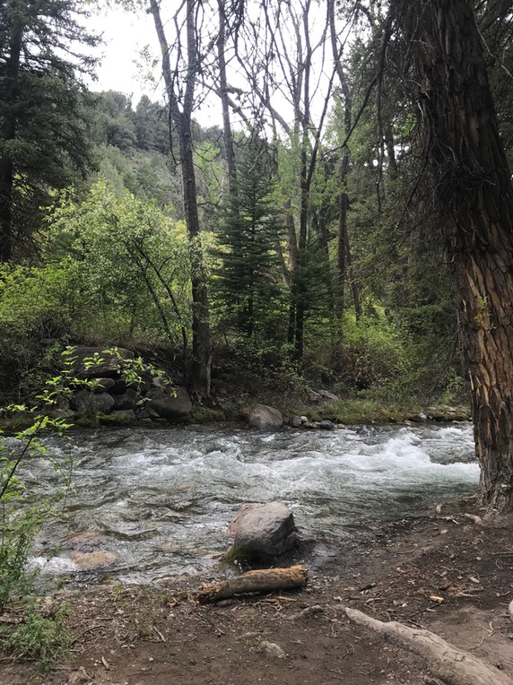
Day 2 5.22
I was up & out of there early heading down the road about 30 minutes to the Hanging Lake trailhead parking lot. I wanted to get a space before it was too crowded. I think this is my 4th time to hike this rugged quad busting hike. They were supposed to start permitting this hike May 1st, due to overcrowding, but it’s now been delayed for a bit. So, I wanted to hike this one more time, before it gets more difficult to get on this trail. The trail is only 1.2 miles to the top but it’s a big 1,000+ elevation gain…so it’s pretty much straight up, but it’s so pretty at the top!
There is an additional hike that’s short that goes right behind the falls to Spouting Rock.
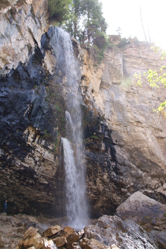
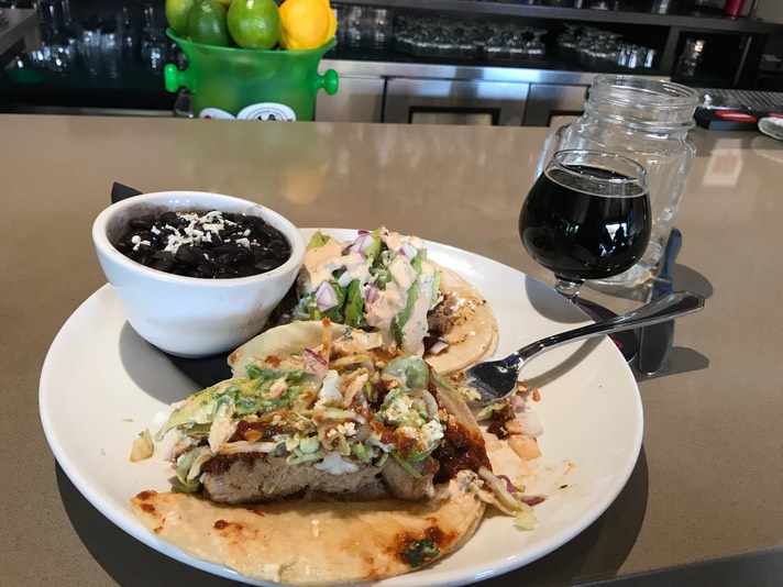
I had to ‘check myself’ a few times on the way down (see ‘attitude' in rAnDoM on last page) but enjoyed having my feet on dirt & the challenge & beauty of this hike. I had an early lunch at Glenwood Brewery & a great chat with the bartender. She was a big hiker & so we spent time talking trails. The food was yummy as well as the beer! I had today’s special: Pulled Pork Tacos & Shoshone Stout.
Then I was back on the highway & headed to Utah. I think this is my fourth trip to Utah…my longest was a few years ago for a month. I never get tired of southern Utah…it’s 5 National Parks, it’s incredible diverse landscape, so much free camping, but the beer is mediocre (I came prepared & brought enough to get me through the state!) On this trip, I particularly wanted to do some hiking in Bears Ears National Monument & Grand Staircase National Monument. They are both being torn apart by our government…leases sold (if you want to get irate about a process, see how the Texas company is making millions taking a cut & selling these leases online) to drilling companies. So, yes, we will still own the land, but won’t have access & worse, roads will be built, noisy trucks will be driving in these amazing places, fencing will be raised & drills will be set up. Somebody will be making money, it won’t be you & me, but it will ruin these amazing places. Guess, they’re not golf courses, so Trump could care less.
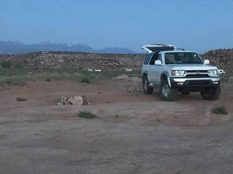
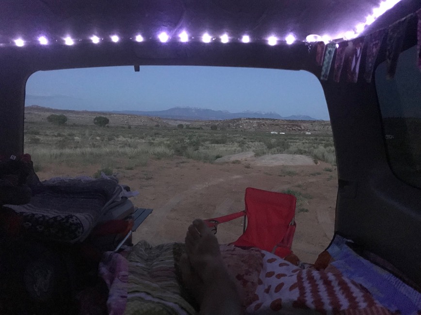
I made it just north of Moab in 2.5 hours & found some dispersed camping on Willow Springs road…it had a pretty nice view of the LaSal mountains.
Day 3 5.23
I was out of there early & heading into Arches National Park. It might be the only National Park I get to on this trip. My pass expires on 5.31, which is no big deal, I can buy another one, but the bigger issue is that Memorial Day weekend is about ready to hit…& with that the National Parks get super crazy & I don’t want to be in one when that happens. So, I was planning on spending two days in & out of the park, making sure I get my two favorite hikes in as well as a few other short ones, then leave Moab before the mass of humanity gets here. I was through the gates early & stopped at a picnic site & made coffee, then enjoyed my drive through this fabulous park. I got a parking place at the Delicate Arch trailhead, loaded my pack & took off up the trail. I’ve hiked this trail everytime I’ve come to Arches & it never gets old!
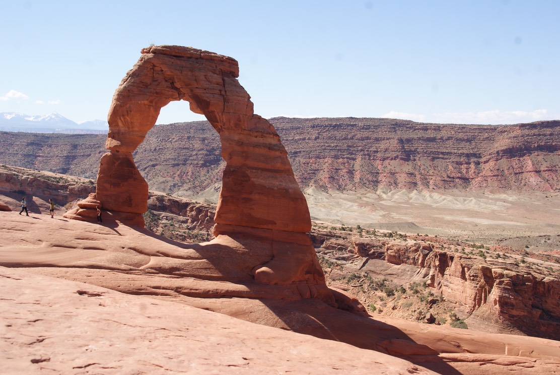
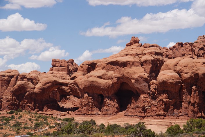
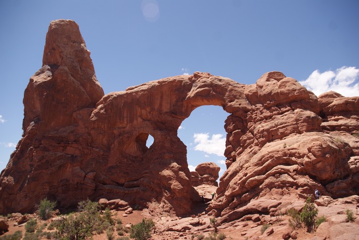
The day was warming up & I took a break at my fave picnic spot for about an hour. Then I drove over to the Windows, Double Arch & Turret Arch…they’re all pretty short hikes. Later in the afternoon, I made my way back to camp, made dinner, got out my book & read for the rest of the night.
Day 4 5.24
Today was a long hike, but I LOVE this hike! The first time I did it was shaky scared, but this is my 3rd time & although my heart still races in about three places along the trail, I really enjoy this 7 mile hike. I started Devils Garden around 8am to avoid the heat & the crowds. The first part of the hike you climb up this long slab of slickrock that has drop offs all around it. I’d never seen it so empty before & it’s really easier to climb when you’re not climbing around others.
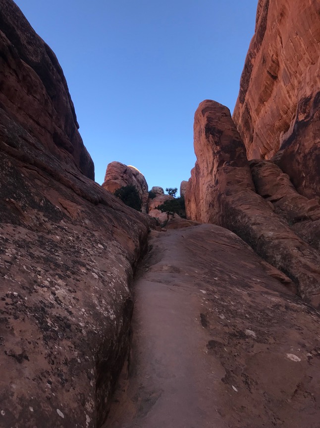
One of the other parts of the hike that is ‘exciting’ is climbing up to this huge rock slab that becomes the trail…& you just hike it until the trail drops off the far end! (You can see a guy ahead of me.)
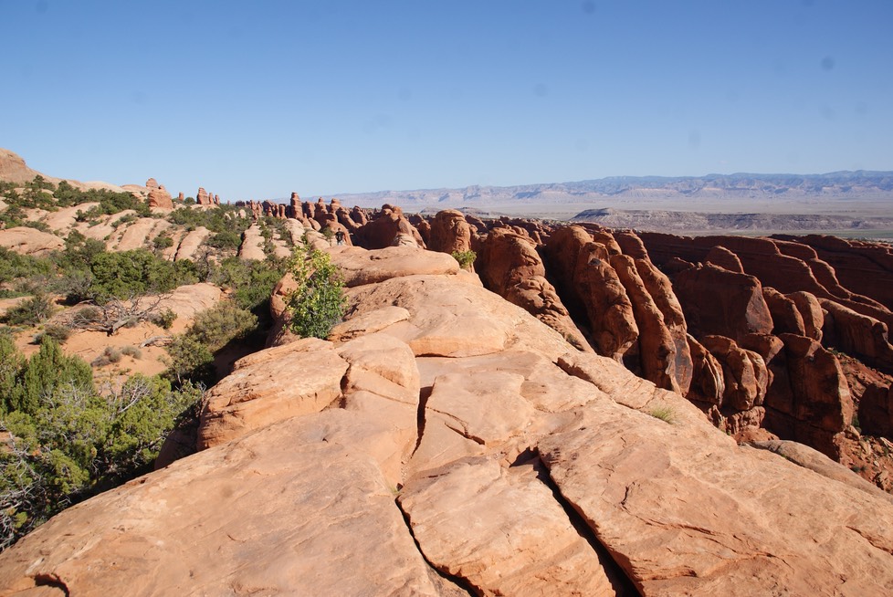
Theres one part where it would help if I were a few inches taller, but I sort of just throw my body up as high as I can & very ungracefully (glad that no one’s ever around) crawl my way up the rock. A mild skinned knee was my only souvenir from this hike, but the arches are fantastic!
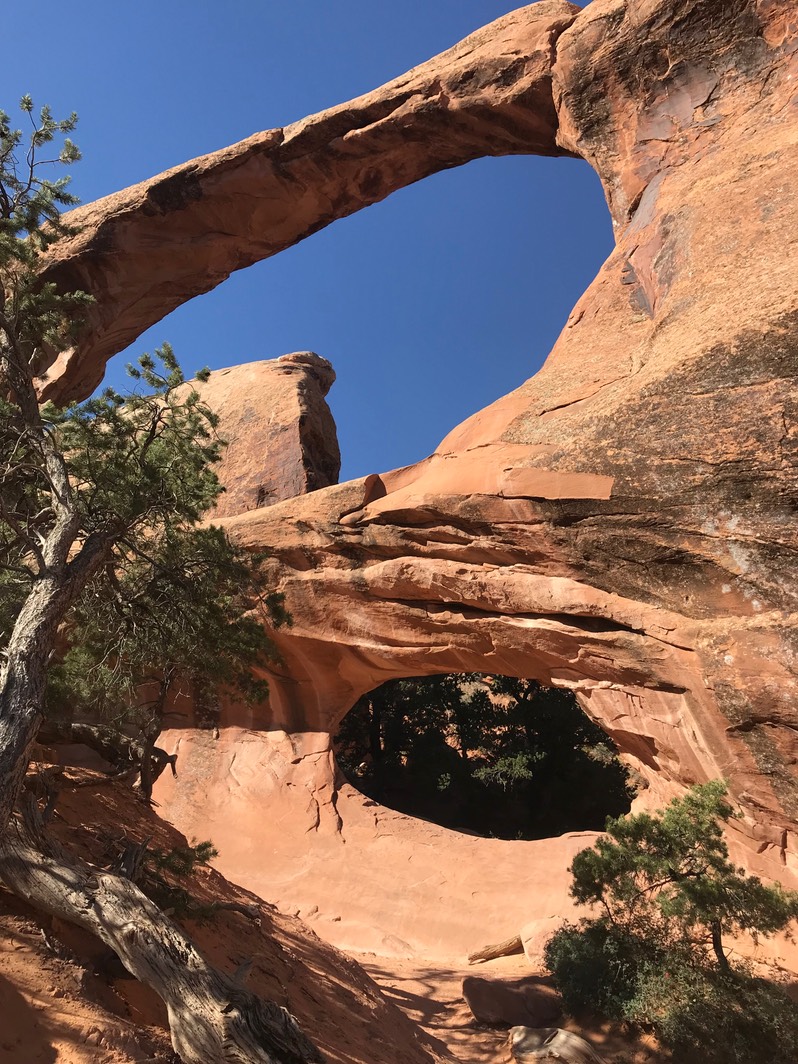
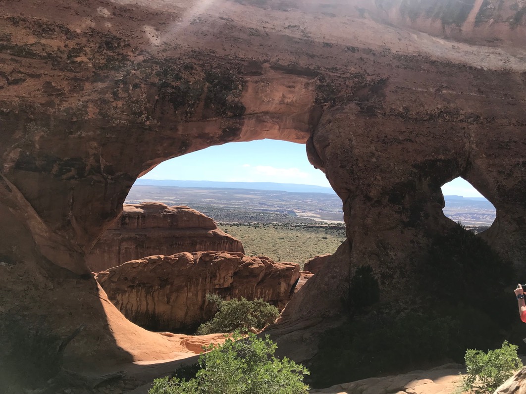
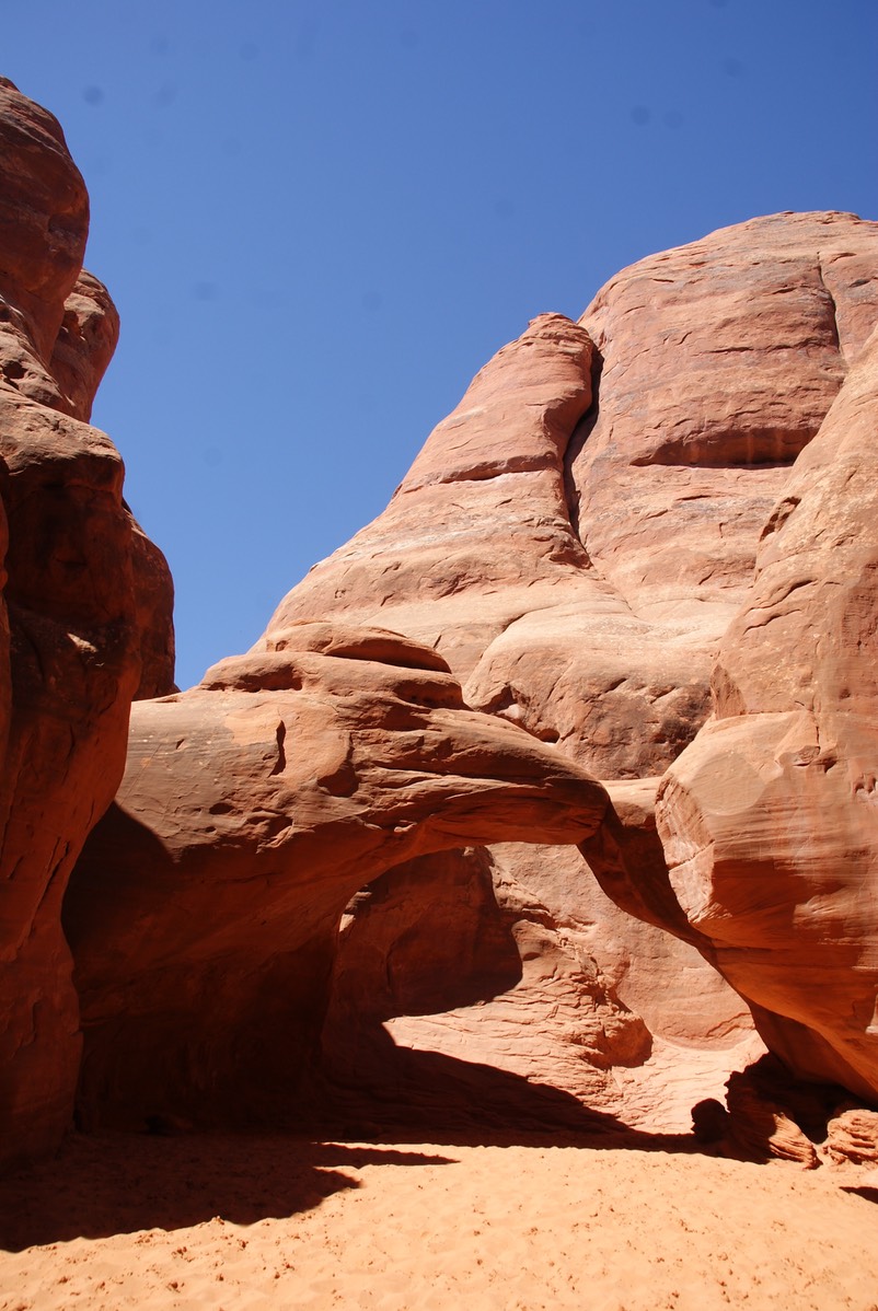
When I was done with this hike, I was a sweaty sticky hiker, but I wanted to hike to my favorite small arch…Sand Arch. It’s at this end of the park, & is really a pretty short walk, but I love that it’s kind of hidden behind these beautiful walls!
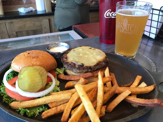
My time at Arches was over. Tomorrow they would block off the south entrance anticipating all the people. They usually have to close the park at some point & not let anyone in due to no parking inside the park when it gets over crowded. I drove into Moab for the first time, got gas, ice & picked up a couple of six packs of Utah beer that Danny likes. The liquor stores in Utah are state owned & they have the strangest liquor laws of any state I’ve ever been in, but I made a quick stop for Danny. Then I went to the Spoke on Center for a burger & beer before leaving town. I keep saying they don’t have good beer here, but my choice today was pretty good…so I guess I should rephrase that…they don’t have much selection & not too many beers I like.
Then I headed towards Blanding. I was looking for a campsite at Recapture Reservoir. But as I drove this pretty stretch of road, I remembered driving it before going the opposite direction. I passed a NF campground I’d stayed at called Devils Canyon because the place I was going to stay was filled with bugs…like so many they covered my windshield. Now I was remembering that campsite was at a lake…& as I remembered this, I was at Recapture Reservoir…it was the same place. Now, I should tell you I have a huge history with no-see-ums. They love me! They think my short spiky hair is the best place to snuggle into & then bite my head! When I was in Florida with Jill in February, I came home with tons of bites on my head (she had them all over her legs…I had zero on my legs.) Once, when I was camping at the Great Salt Lake, I never felt a bite…but ended up with 30 on my head by the time I left there. I even came home with a few from my Texas trip to Palo Duro in April. And, I was sporting some from my last two nights in Utah. These bites are so weird. They start out as a giant lump…hard & about the size of a nickel (although as I type I have one the size of a quarter on the back of my head) then they turn into a tiny pin prick size scab…just lovely. This trip they’ve attacked my head, face, neck & collarbone area. I look amazing! They do itch, but not as bad as mosquitos bites. Don’t know what it is about these pesky insects, but they love me!
There was no way I was going to stay at this campsite. I stopped at the Visitors Center in Blanding & they guy gave me tons of info…some good, some not so good, some opinionated, but it’s a wonderful VC that I’ve stopped at before. He told me about a dispersed camping area just north of town or I could choose a NF campground up the same road in the forest. He told me about this amazing 60 mile road I should drive. Of course, because I’m backroad-phobic, I had to ask my standard 50 questions…Is it sandy? are there giant rocks? big ruts? washboard? drop offs? steep? holes? water crossings? etc. etc. He assured me I could drive this road (of course he asked if I had 4WD). He gave me tons of papers. He also gave me his opinion on Bears Ears & I could tell he agreed with our President about busting it up. Of course, most of the politicians in Salt Lake City want it busted up too. I listened, but as much as I could tell his views, he could tell mine. And he told me the wrong boundaries too. I needed to call Danny before I left Blanding to tell him my change of plans. He was busy at work so while I waited for him to call me back, I started researching the scenic road this guy wanted me drive…I never just take one persons word about these backroads. It makes a difference where they’re from…if you ask a person from Kansas about backroad driving, it’s totally different than if you ask someone from Colorado or Utah….way way way different. So, I started reading & soon enough, one google link took me to this site:
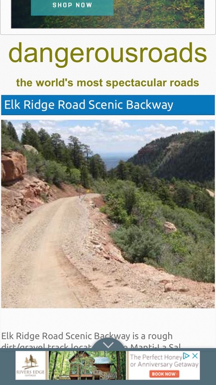
Ya…I wasn’t doing that. I had actually been to that site last weekend before I left home looking at a road I hoped I didn’t have to drive on later in my trip much farther south in Utah. I finally talked to Danny, & did drive the road for 10 miles up to the campground but had driven by a ton of dispersed sites along the way. I backtracked to a pretty site in the forest, set up my camp & read for the rest of the evening. PS: The no-see-ums still managed to find me, but I outsmarted them this time. I put my BUFF in skull cap mode around my head, pants & socks on & long sleeved high necked jacket. The only thing exposed was my nose & my glasses…take that bugs!
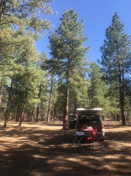
Every place has a burn ban on, so no campfires. I wouldn’t be surprised if I never get a campfire this year….the low levels of snow this year will have bans going until fall & we’ll be lucky if it’s not a horrid wildfire season.
Day 5 5.25
I slept good in my quiet spot with no one around. I backtracked south to Blanding, & drove west towards two hikes in Bears Ears. They’re both fairly short, but to some ruins that are pretty cool. The first was called Butler Wash & you were able to see the ruins in the rock across a small canyon.
The trails back here are pretty primitive, but some are marked with cairns.
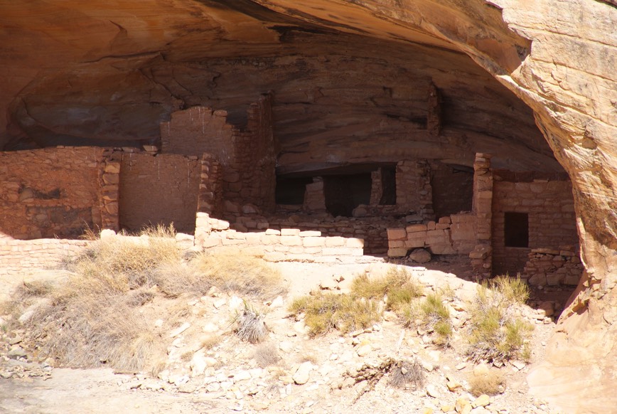
The next hike was down the road to the House on Fire ruin. OMG! This was so spectacular! This trail goes down into the canyon, then winds back along a dried up creek. Right before you get to the ruin, you walk up the slap of rock & there it is. You could walk right up to it! This ruin is so fantastic because the rock above it is kind of layered…if you come here when the sun is setting it reflects on the ruins to make them look on fire. I was here during the morning, but I still thought this was so special! I was there for awhile, just taking it all in!
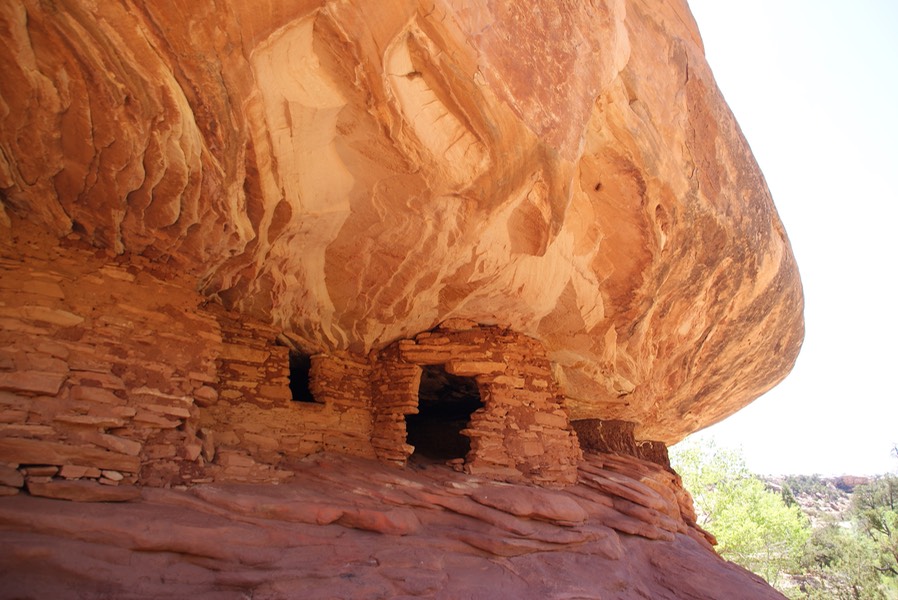
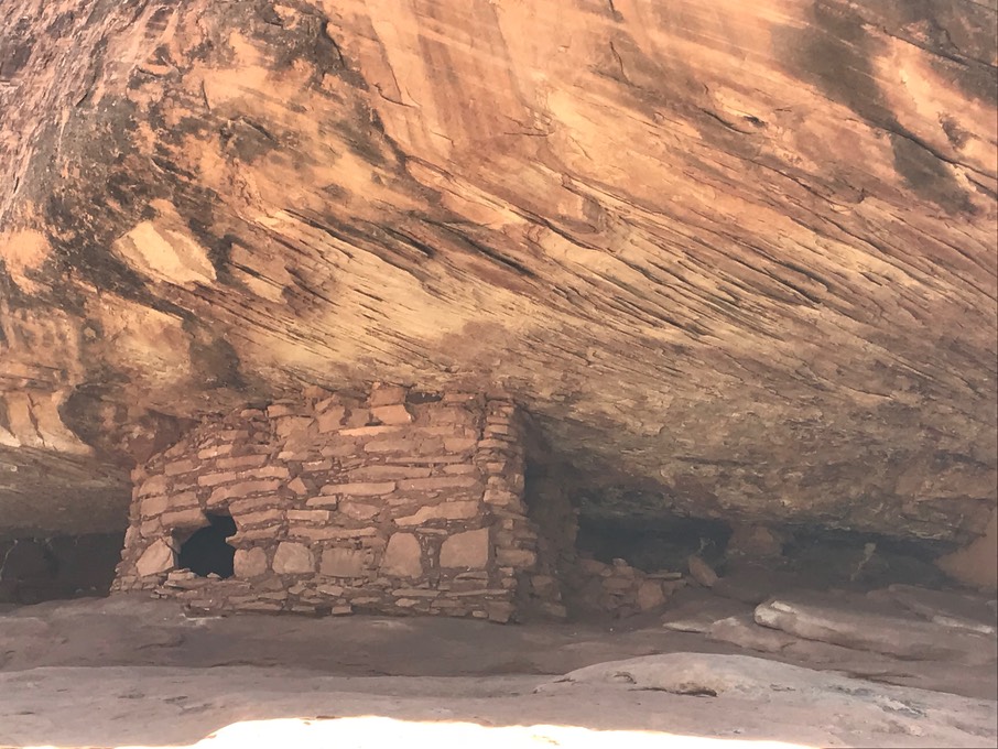
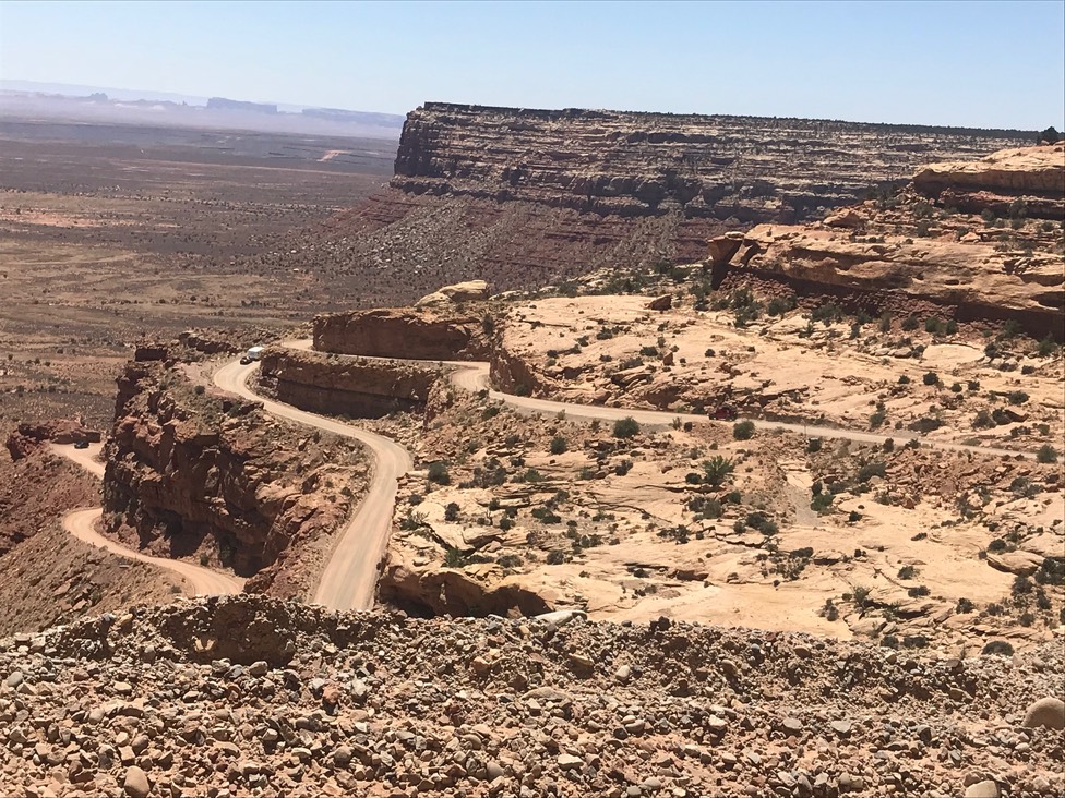
I was stoked as I hiked back to the 4Runner! I was also in denial….while I was planning this trip, looking over maps & atlas’s, I noticed a small section of road in one area I wanted to travel to call the Moki Dugway drive. It’s 3 miles of gravel, super steep & narrow with drop offs. I’d even watched a video on it & it was the road I read about on DangerousRoads. But, I told myself, this was a nearly 30 mile long paved road, going from one section of Utah to another…a place where RV’s probably outnumber cars…it must be an ‘optional’ drive….you know like a turn off that you can choose or not. Then when I was at the VC in Blanding, the super informational guy circled it on the map. Now that I was actually getting ready to drive that stretch of road south, I looked closer at my atlas…there it was. The paved road line stopped & there was this little squiggly black line…seriously? Once I turned off 95 heading south, there was a big yellow sign stating vehicles towing, oversized, etc. should not drive this road because 23 miles ahead was curvy nightmare…well, that’s not what it really said, but that was what I read. I had one more chance to check it out. On my way down this road, was a BLM office & I wanted to ask them about a hike in Bears Ears to do tomorrow on my way back up (yes, I planned to backtrack). The guy in there was super great telling me about a different rim hike (or that’s what I thought I heard…more on that tomorrow) instead of the rim hike I was originally going to take. That sounded nice…of course the trailhead was a mile down a dirt road, so I asked my 50 standard questions & deemed the road ok. I told him I was headed to Valley of the Gods to camp tonight & asked him my standard 50 questions about that 17 mile dirt road drive…then I was good to go. Then he said “And you get to drive the Moki Dugway on your way down”….really? It’s not optional I said? How bad is it? There was an older gentlemen that was standing in there too & when the BLM guy said “it’s fun!” the other guy boomed out a laugh that lasted for a couple of minutes. The BLM guy also said to drive to Muley Point….it was beautiful.
So, here I go. It was a pretty drive on the way down & took my mind of what was to come. But, before too long, I was on gravel, in low gear & turned my 4WD on just because it made me feel better. I also turned on my “don’t freak out super calming’ music…because somehow I never believe I’m going to plummet over this side when I have gentle sweet lovely music playing. It really wasn’t that scary, my palms were sweating a little & I was in super concentrating mode, but I made it all the way to the bottom safely & not shaking. It made a big difference that most of it is wide enough for two cars to slip past each other…only a few places where it’s not. (Yes, you do see in the pic below a guy towing a trailer…I wonder if he was nervous? #rulebreaker)
The turn off to Valley of the Gods is immediate & now I had 17 miles of dirt to drive on. I was looking out for sand & washes which leave piles of sand. Sand is like driving in ice…no control. It’s also eerie in the fact that when your tires hit sand, it’s deadly quiet…no noise, sometimes followed by no movement. But the BLM guy said it was a great road…& for the most part it was. All these ‘red roads’ (which is what I call them) in Utah all have the same sign posted at the beginning of every road…”impassable when wet”….I had diligently checked the forecast & no rain in sight. It really was a good road & my SUV had no trouble. There were some giant ups & downs, where you’re car went up so much you couldn’t really see what was on the other side, but I took my chances. The BLM guy told me to drive about 1/2 way before choosing a campsite…he said, “you’ll see one & say…wow that looks great!..& then drive a little further & see another one & say that looks really cool…& on & on” & that’s what happened. I chose one at the highest point in the valley & it was wonderful. For being a holiday weekend, I had one neighbor drive in but where they camped, I couldn’t see them at all. And I had a little cell service so I was able to visit with Danny. I could see about a mile in one direction & about 1/4 mile in the other. So I was able to watch all the vehicles going by…some were slipping on the steep parts, but everyone made it through. All around me were these huge red bluffs…it was really magical. The stars popped out as well as the almost-full moon & I stayed up late just looking at the sky.
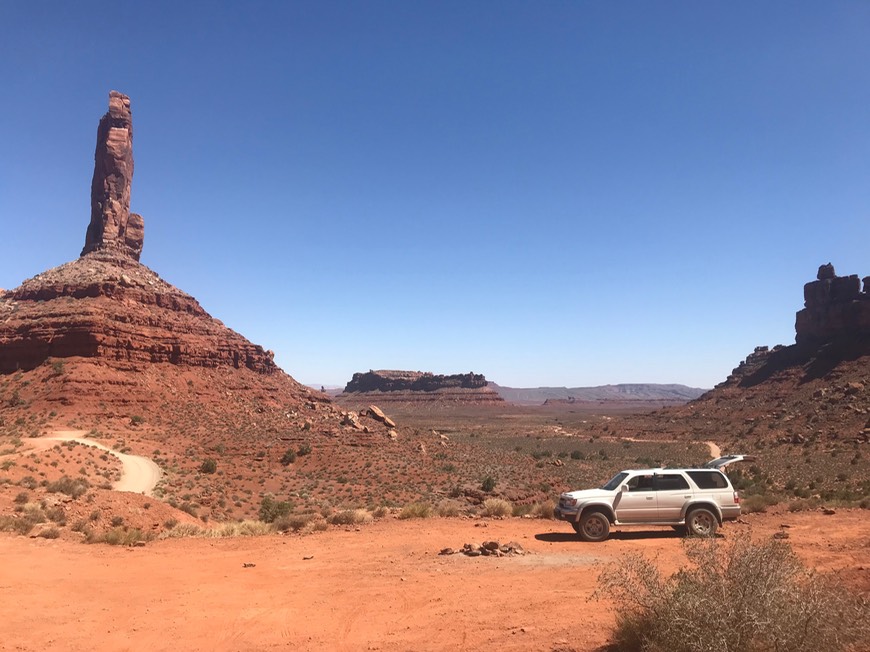
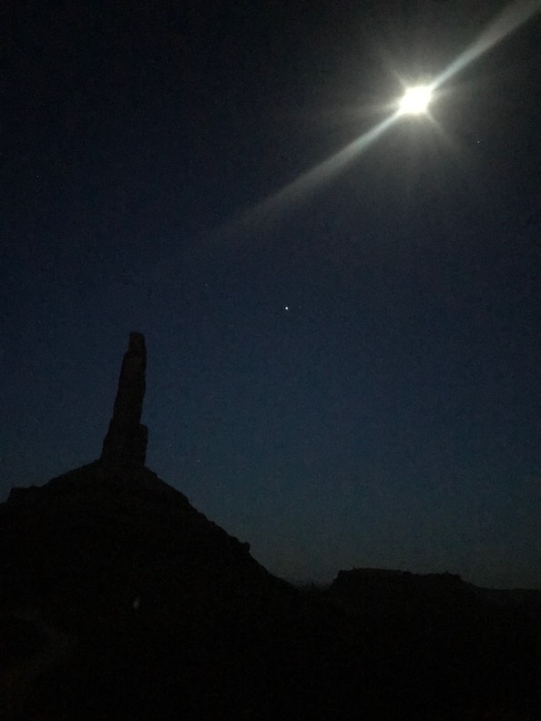
Day 6 5.26
The next morning I took off to finish the drive out of Valley of the Gods. There isn’t much to do here except camp, but it was a perfect site! On my way out, I spotted a pop-up truck camper…my latest new obsession. I could see the couple was up & looking like they might be leaving in a few minutes, so I pulled into their spot & ask them if I could visit with them for a couple of minutes about their camper. They were gracious, informative & super nice, inviting me to look inside & watching as he popped it down. He was driving a Toyota Tundra so we talked trucks & our love of everything Toyota (he was a former 4Runner owner). She was from Bisbee, so her & I hit it off immediately talking about that wonderful funky quirky town & a couple of people I met when I was there. It was a nice way to start the day & I learned more for my ‘research’.
I left Valley of the Gods & drove down to Mexian Hat..but I’m not sure why. It was kind of a waste of 6 miles. On my way back I drove over to Goosenecks State Park…for $5 you get to see these rock formations in the San Juan river (& I used their picnic table to eat breakfast, their bathroom & their trashcan…a bargain).
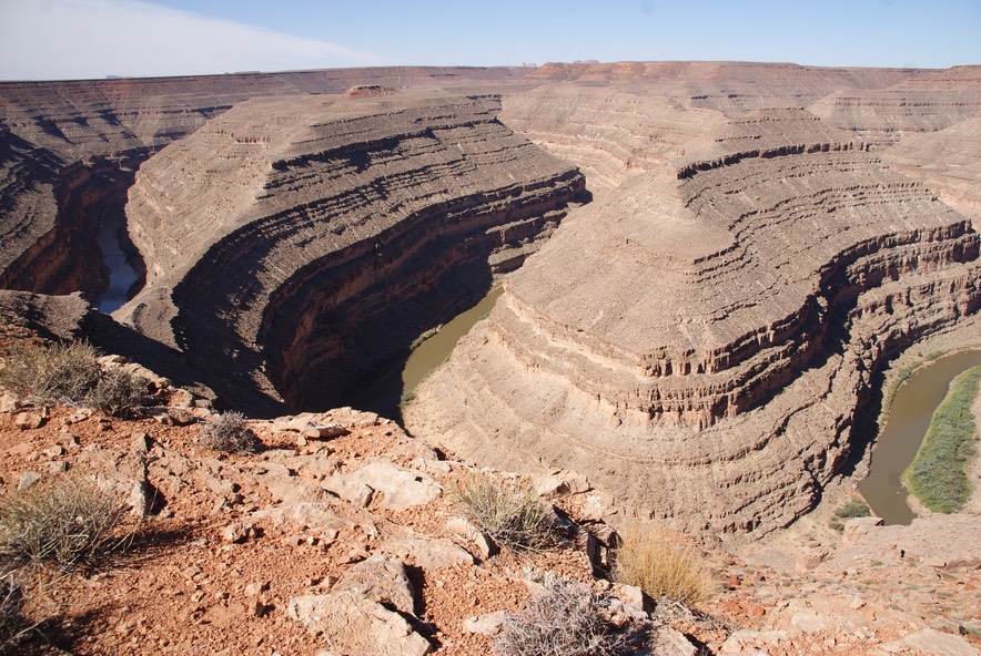
After my trip to Goosenecks, my palms started to sweat again. I was on my way back to drive UP Moki Dugway. By the time I got to the lower part of the road I was wiping them on my skirt, but in 4WD, with my music gently playing, my AC off (I take all precautions in my 17 year old vehicle) & ready for the challenge. There were two cars pulled off to the side (there’s only two places that can happen & one is more of wide spot) & 6 motorcycles coming down in shifts, but no one in the super narrow spots & the three miles went pretty fast. Then I took a bone jarring ride down the washboard road to Muley Point which looks out over the whole valley….it’s really beautiful! But, I really don’t like driving that many miles on giant washboards…everything in my car is shifted & fallen & moved & the fillings in my teeth feel slightly looser too.
Now it was time to hike the Bullet Canyon hike the BLM guy had told me about. I found the turn off & went down the dirt road to a full but primitive trailhead parking spot…everyone was parked on top of slabs of rocks & I had to slither in under a tree at some weird ass angle. I got out, got my pack, paid a $2 permit fee & took off down to hike this rim hike. Except it wasn’t a rim hike…it was a hike down into the canyon. I found the trail easy enough, but then it started dropping fast. There were some cairns going down, but some of the trail was super narrow. I got half way down to see into the canyon & could see trails going everywhere…to the right, to the left, sideways. I knew this trail intersected with another in 7 miles, but I had no idea which way to go once I got to the bottom. As I started to go down more, I kept looking back to see if I could see the cairns to show me the trail once I came back. I couldn’t. The trail was too narrow there. Plus there were piles of rocks everywhere. I had no map & couldn’t see anyone else in spite of the trailhead lot being full. I stood & thought & looked around…then I aborted my hike. Even if I’d seen some others, I need to know how to get back myself. I hate turning around on hikes, but I’d hate getting lost more.
Here’s a shot of the Bears Ears rock formation the National Monument is named after.
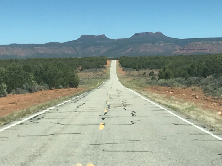
I drove by Natural Bridges National Monument & briefly thought about going to hike there. I’ve done almost all the bridge hikes there & it’s a cool place, but I decided to keep going & drive during the hot part of the day.
The next section of driving is LONG & remote & drop dead gorgeous! It’s so UTAH in it’s amazing scenery. It’s about 100 miles with no services. You drive by the enormous Fry Canyon…a place I know nothing about, but it’s on my list to research, for hiking & for history. Then you drive through Glen Canyon Rec area & the wonderful Colorado River. There’s a view point a few miles past the bridge, that I love to stop at (this is my third trip to this point). I was there all alone & took a walk all along the ridge. It’s so special to see this river…I really hate the fact that it’s dammed up farther down at Lake Powell. But in this spot, it’s running free. It’s also running really low…not a good thing.
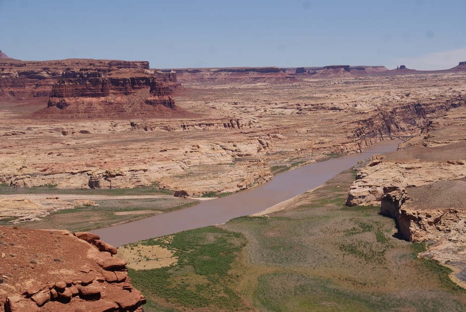
I got to Hanksville & filled up on gas & ice & a long call to Danny. The area right before & right after Hanksville is not that pretty, but then the highway takes you through Capital Reef National Park…such a sweet little park. But, this being Saturday of Memorial weekend, all the trailheads were overflowing with cars. I’ve done hiking here on two different trips, as it was never my intention to stop & seeing all the cars made me think that was a good decision. I turned from going west & now heading south towards Boulder, which takes you from the rocks to the forests…up to over 9,000’ in elevation…just wonderful scenery.
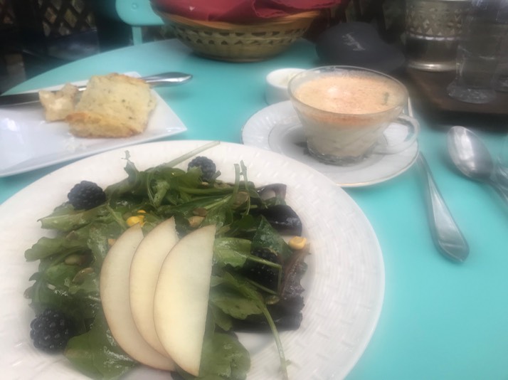
A new friend of mine told me about an awesome place to eat called Hellsbackbone Grill….named after a road in Escalante that does not pass any of my 50 standard questions. I would visit the grill, but not the road. She is a former river guide & one of the owners is a former guide too. Once again, my craziness rears it’s clueless head. I had looked up this restaurant & thought I’d seen it was BBQ….a famous place, lots of good reviews. By the time my long beautiful drive was over, my mouth was watering for BBQ. However, I had remembered that they closed at 2:30 in the afternoon & reopened at 5pm for dinner…kind of strange for a BBQ joint. These are the kind of red flags I miss all the time…have my whole life. Even when I really try to pay attention, listen, double & triple check, this kind of crap happens to me over & over. I pulled into their parking lot at 4:30 & pulled up the website. It’s not anything like a BBQ place, it’s high end, farm to table, need reservations (& probably a shower within the past few days) kind of place. Uh Oh…so I called. They had a place for one if I could get there promptly at 5 (no problem, I was already there!). Then I called back to see if they had a dress code (I never eat high end, so I don’t know what they expect), but the person on the phone laughed & said I could dress up or not, most people come in their hiking clothes. I’d fit right in (except for the shower part!)
The food was sooooo yummy! I had a cup of jalapeño avocado soup & their house salad…divine!
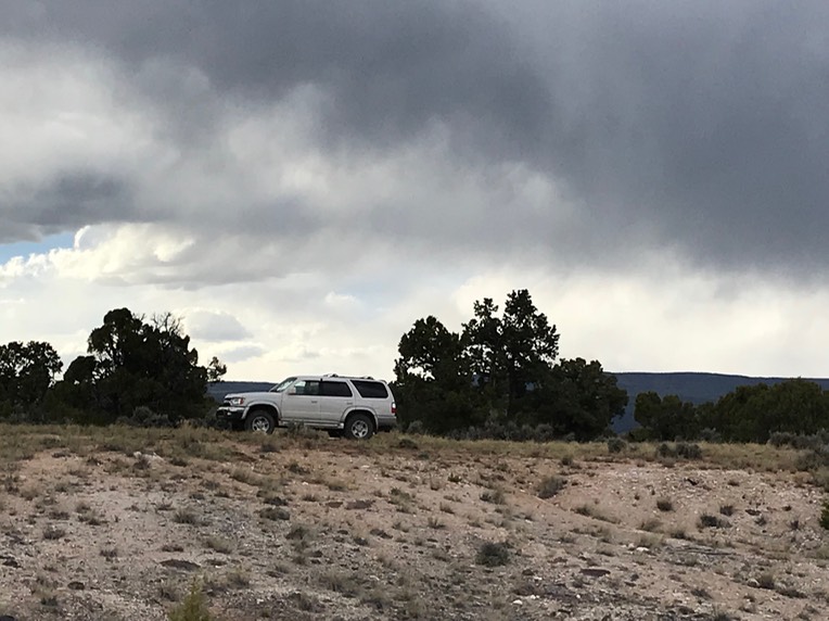
Now it was time to find a camping spot. The skies were growing cloudy, the temps were dropping & the wind picking up….maybe a storm. I knew not to find camping down a red road (roads impassable when wet!), so I found a nice white gravel road with a view, pulled off & tucked myself in to read until I fell asleep.
Day 7 5.27
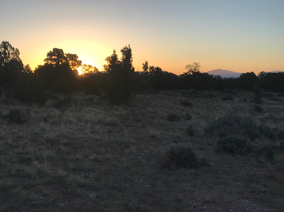
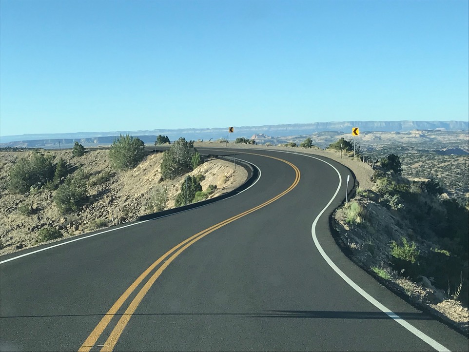
I watched the sunrise this morning…so pretty. Back on the road early to get to the trailhead. Grand Staircase Escalante is such a beautiful place! Giant slabs of rocks & canyons, white, red, orange…so much to look at. The drive to the trailhead takes you a great road, but narrow & windy & over the Hogsback…literally on a huge slab of rock & up & down & up & down.
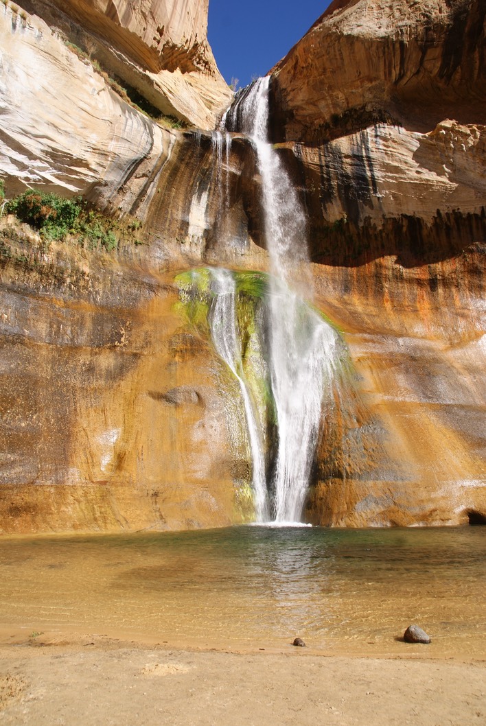
I’ve hiked Lower Calf Creek Falls before & loved it. I know there will be a million people here, but I was trying to beat most of them. I managed to get a parking space & was headed to the trail by 8am. But…I spotted a pop up truck camper…the one I’ve been doing the most research on. And, someone was outside standing beside it. Her name was Laurie from British Columbia. Her & her partner are taking a super long road trip into the states & will even do some winter travel this year. She was great & super enthusiastic about her camper. She’s a badass when it comes to driving backroads…I don’t think she even has one standard question. But she loves her camper & her Toyota 4x4 Tacoma. It was another great conversation & I learned more.
Then I started on the trail. This trail is 95% sand…a workout for sure. It’s 3 miles to the waterfall. I was hoofing it in my Chacos…my preferred foot cover when hiking in sand & on slickrock. The waterfall is spectacular! The trick is to get a photo of it without 20 people in it. When I got there, there were 10 other people already there. I started shooting right away because I knew it wouldn’t last. Then Hulk Hogan the cross fit half naked king thought everyone would enjoy seeing him swim to under the falls along with his dog. So, we all waited for him to get out of our pictures. Then he thought we’d love to see his dog fetch a stick underneath the falls….& on & on. 10 more people & three more dogs arrived. I clicked when I could. It’s a lovely waterfall, & I was glad I’d gotten to see it again. Then I left. I passed 100 people on my way back. I had to continually “check myself”. Once back at the car, I pulled out of the car lined lot, to closed gates. Three workers were blocking the gates & only letting people out. Cars were lined up & down the highway. Crazy Crazy!
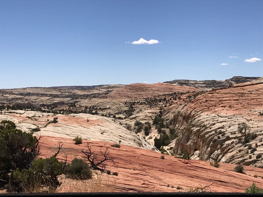
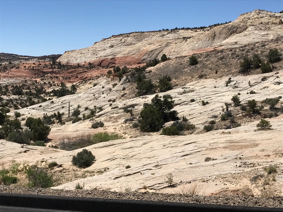
I’d wanted to do the Escalante River hike today too, but as I drove by the overflowing trailhead, I changed my mind. The town of Escalante is tiny & about 10 miles from where I’d been hiking. But the drive to get there is breath taking!
I went to the Visitors Center once I got to town to ask the Ranger about a hike Laurie had told me about. They always have a ton of good info. She told me how to get to the hike, but then added if I was at all allergic to poison ivy there was a ton of it there. To say the least, I don’t even want to park by poison ivy. She told me about another trailhead in town to hike the River trail…yay!
I glanced up above the door on my way out to see to smiling portrait photos of Trump & Pence…both trying to also bust up Grand Staircase Esclante so they can sell leases to line someones pockets…pretty ironic huh?
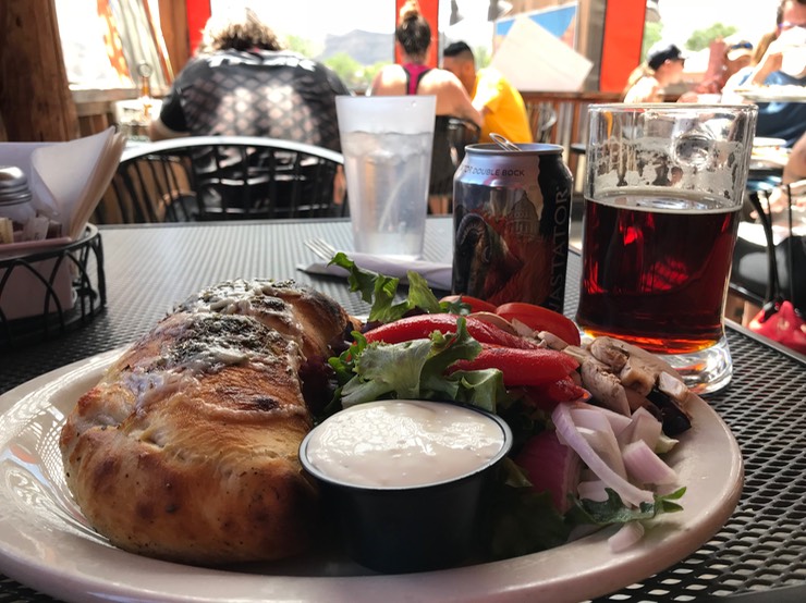
I decided to eat some lunch so I went to the Escalante Outfitter & Cafe…gear shop, food & beer…isn’t that just perfect? I ordered a calzone & salad & a beer & ran into Laurie & her partner eating there too. We visited after we all had finished & once again wished each other happy travels.
After lunch, I drove to the trailhead. The River Trail follows this low flow (at this time of year anyway) river, crossing it 14 times (each way) in the couple of hours I hiked it. The huge canyon walls loom above you & are so wonderfully colorful.
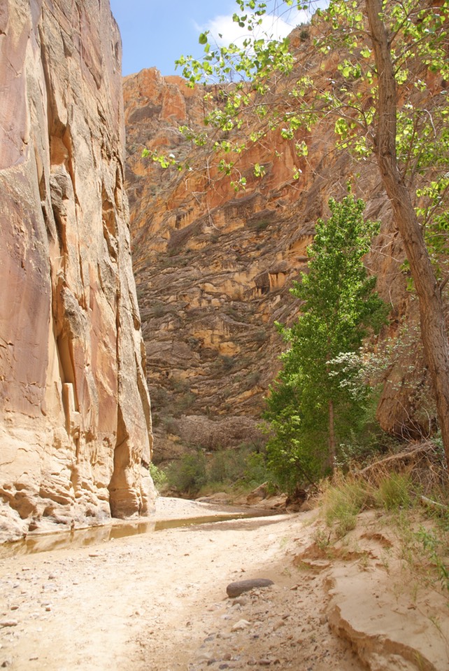
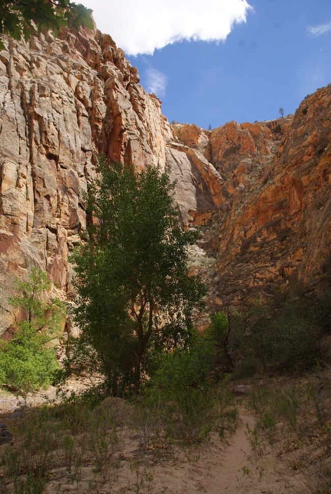
It was a nice hike, but from my first steps on the trail, I could feel this mornings 6 mile sand hike & this one was mostly sand too. The skies were growing cloudy & just like yesterday, the temps were dropping as well as a few rain drops. I’d hiked at least 10 miles today, mostly in sand & I was tired. I got back to the car, called Danny & headed south out of town to look for tonight’s campsite. About 10 miles up the road, in the Dixie National Forest I found a nice spot with a pretty view.
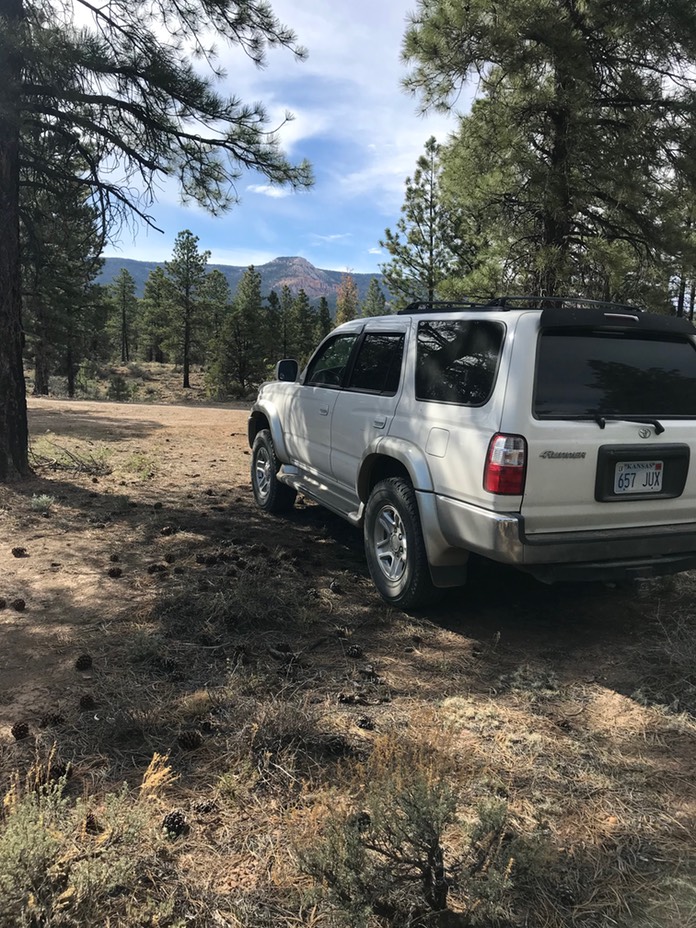
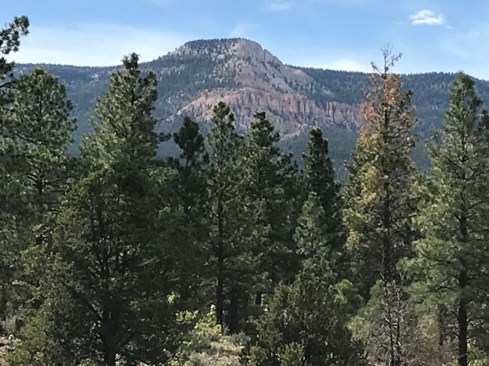
It’s now pitch black & past midnight. I have spent the evening working on the website. I have no cell service, so I’m not sure when it will get published. Sometimes it seems like work, but mostly I love reliving my experiences! Now it’s time for bed.
Day 8 5.28
Trying to avoid the National Parks has sent me to some new places for sure. It’s Memorial Day & I knew the crowds would be huge. Kodachrome State Park was on my route & it turned out to be a real gem! The park has a total of 12 miles of trails…the longest being the Panorama trail, so that’s where I began. It’s a 6 mile trail with rock formations along the trail but a longer hike to a really Cool Cave (that was the name of the cave!)
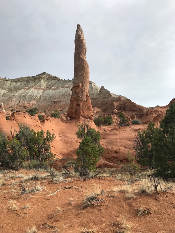
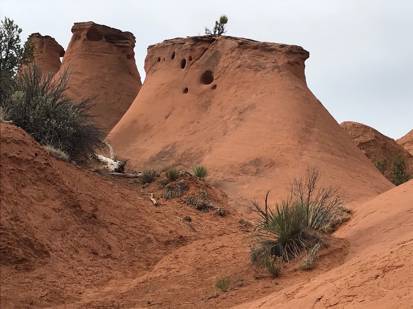
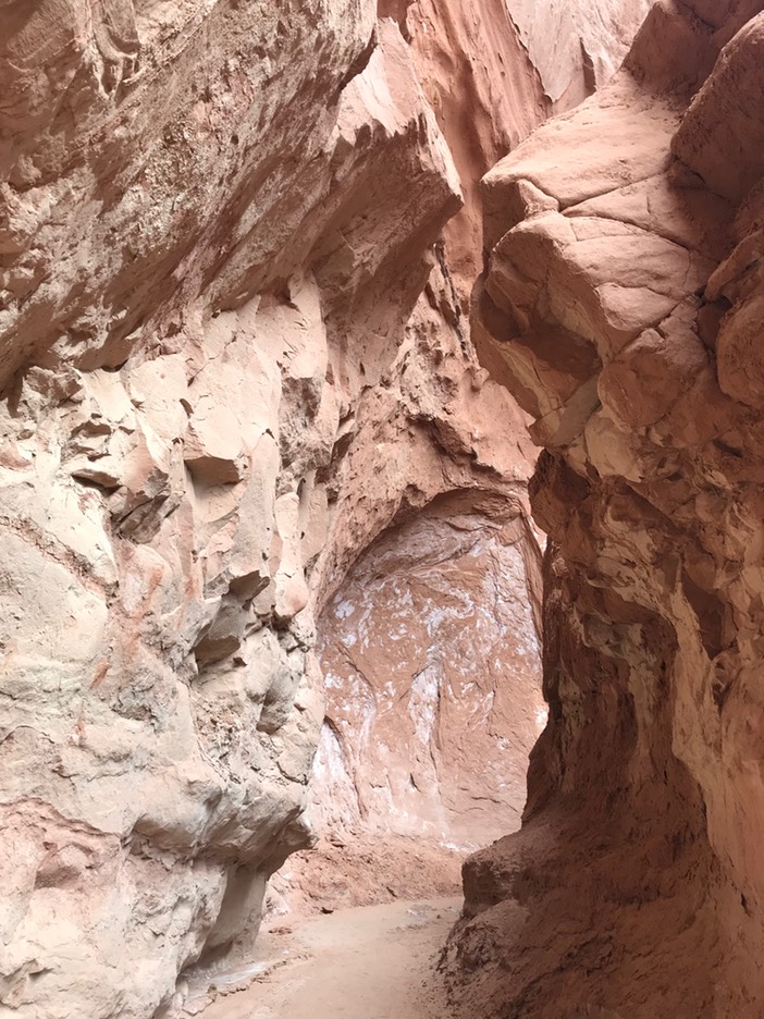
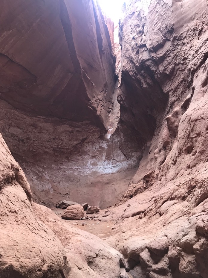
The sky was getting dark & I was wondering if it was going to rain…but it only sprinkled as I made it back to the car. It was a more taxing hike than I’d expected…lots of ups & downs but super pretty & some nice big views.
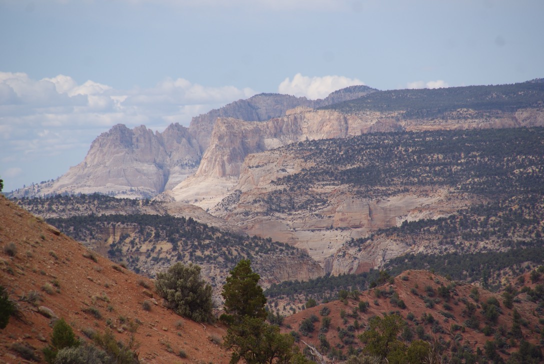
Once back at the car I ate a snack then decided the drops of rain wouldn’t keep me from one more hike. This was called the Grand Parade & was a pretty flat 2 mile hike, but it led back into two different box canyons that you could go into to explore! It was fun hiking back into both of these.
The big event of the day was a shower!!! When I paid my entrance fee to the park I noticed a sign that read non-campers could buy a shower for $1…that’s a huge bargain. And they were so nice, private, clean & lots of fast hot water. It felt great! I really didn’t want to hike anymore today, because I just wanted to stay clean! It turned out the skies grew darker, with more sprinkling, so I decided to do some laundry at the park had a brand new laundry facility… one of the nicest laundromats I’ve ever seen.
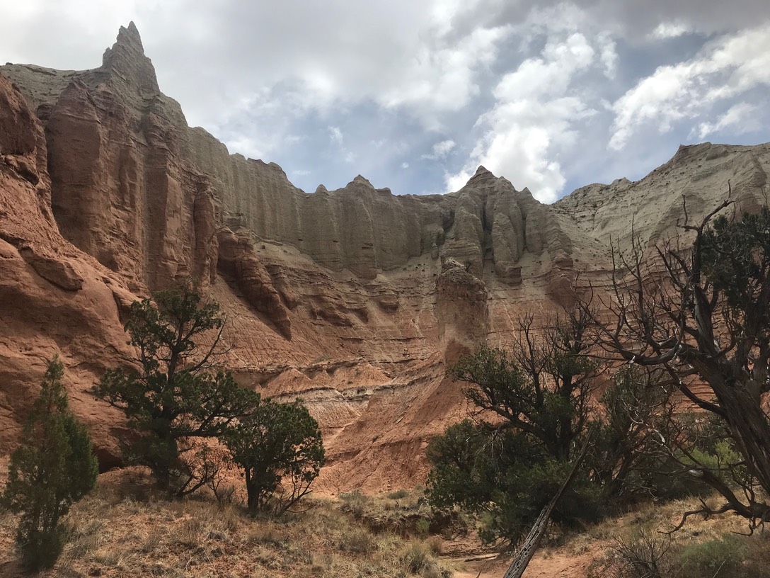
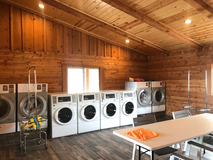
Me & my clothes were so awesomely clean, I decided to be done at the park for the day. There was only one other short hike I wanted to do, & it was a little bit of a climb to a super exposed area, so I decided to move on with my plan of heading to another area to hike. I was driving right by Bryce Canyon NP which I’ve been to twice before. The drive from Kodachrome to Red Canyon is so beautiful & I was enjoying the scenery. I pulled into the Visitors Center & asked about hikes in the area. She told me of three small ones that left from the VC & I asked about one I’d read about called Arches hike & also about some dispersed camping in the area. I was so tired…mostly from the 10+ miles of hiking on sand yesterday, I decided to go find a camp spot & hike those hikes tomorrow. I found a nice site among the trees on National Forest land & set up my table & chair…for about 5 minutes. The rain poured & some thunder boomed, so I moved the dinner party inside. I had cell service so I FT with Danny & the cats ;) It ended up raining off & on for the rest of the evening. I was at about 7,800’ elevation, so I put on pants & my down jacket. After being in the high 80’s low 90’s in Moab, it was chilly here.
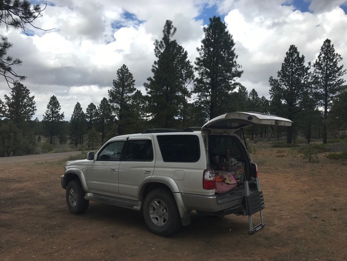
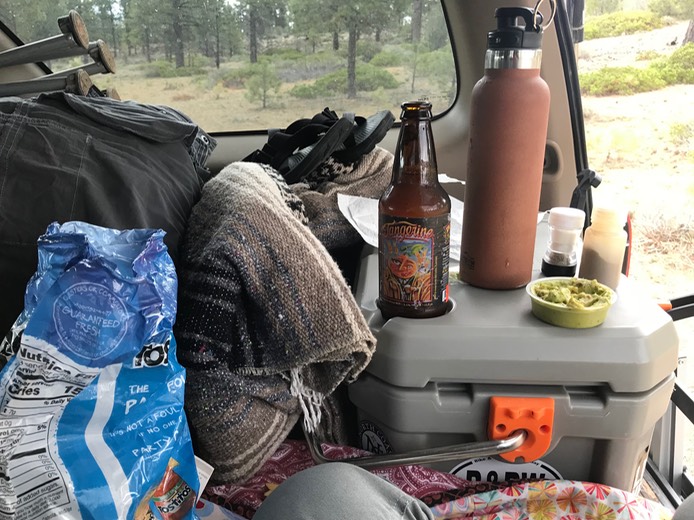
Day 9 5.29
The temps were supposed to drop into the 30’s last night, but I don’t think they did…it wasn’t very cold at all in the middle of the night or the next morning as I woke to bright blue clear skies. I drove back to the Red Canyon VC & started on the three short hikes which were up & down, sometimes steep, but really cool. Everything but the trees in this area is canyon-red…really fantastic!
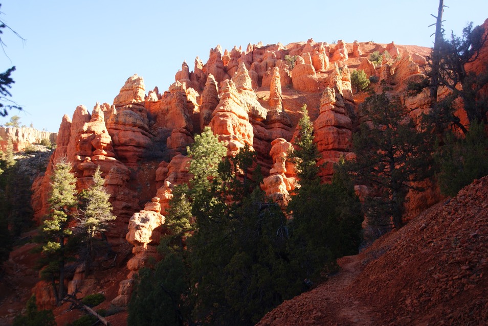
I wound my around around & in & out of all the formations. One of the hikes was called Pink Shelf & you could really see the pink in some of the rocks.
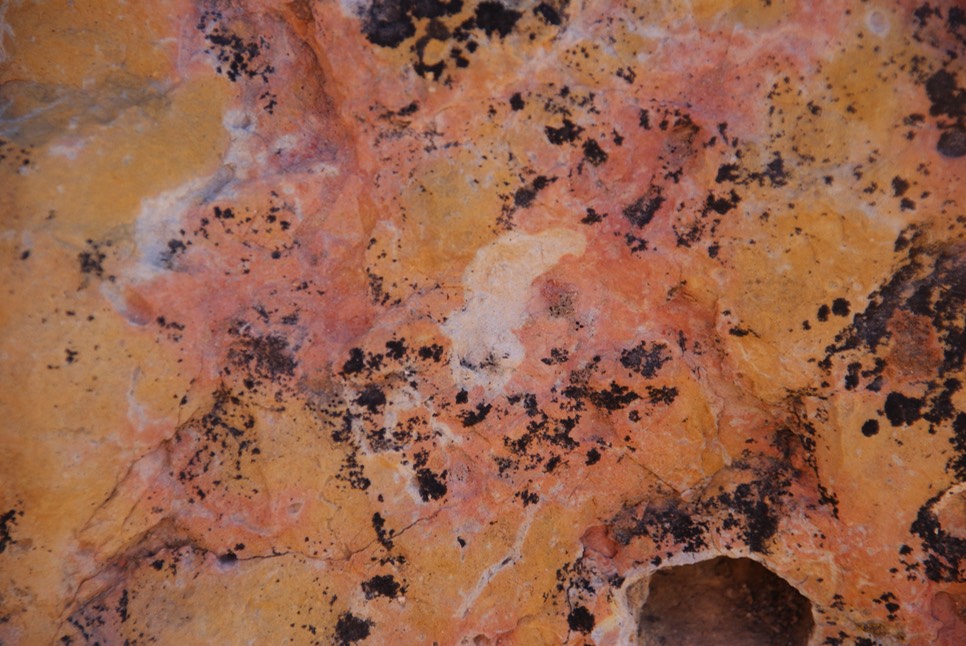
There was also a Hoodoo hike & a photo trail hike. Then I drove down the road a mile (see rAnDoM for my disaster of the day) & back into the canyon 2 more miles to a short trail called Arches. You were supposed to be able to see 15 arches in about a mile. The guy at the VC had told me which direction to take on the loop hike & that in order to see the arches to had to look for 3 unmarked random trails that went off the main trail. These trails were super steep; he suggested I just slide down them on my butt when I was ready to come back down them. So, I found the trail head & started on the marked trail. I saw a random trail going off to the left (which is the way he told me to go) so I took it…but was it a random trail or the loop to left? I hiked up & up & up…this was not a short butt sliding kind of trail, so I guessed I was on the loop. I found wooden stairs to go up, so then I knew I was on the loop. Soon I came to this really cool formation:
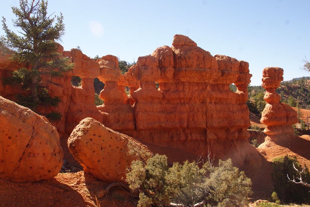
Then I just kept going….never seeing any ‘random steep’ trails off of the main one. It was a nice hike, super steep, but this formation was the only one I saw…not one arch! I wasn’t going to go back to try & find them…I’d leave it for another day. Back at the beginning of the loop was this really cool little structure: I don’t know what it’s history is, but I bet it’s interesting.
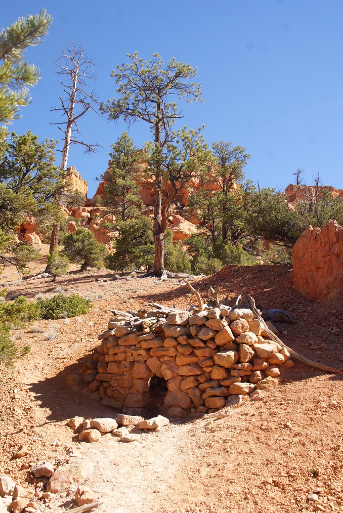
So, in my trip planning, I’d originally planned to go up to Cedar Breaks National Monument, one of southern Utahs highest places, which just opened Memorial Day, then around & down to a part of Zion NP I’d never been to before called Kolob Canyon. But in looking over the details a couple of nights ago, I found notifications on the NP page that Kolob Canyon was closed all this summer because they are repaving the park road…no access to any of the trailheads. I still wanted to go to Cedar Breaks, so that’s where I drove next…it’s a little over 60 miles from Red Canyon (I think I remember that right.) The drive up to the park was interesting…almost immediately after you leave Red Canyon, everything turns green & lush…something you don’t see in southern Utah very much. Then you get a place that looks more like Colorado or Idaho than Utah. As you drive, you climb & climb & climb going through the forests. I noticed I was driving thru a burn & also areas where there are huge black rocks among the trees. I was excited to do a 4 mile hike in Cedar Breaks to see a Bristlecone Pine tree…the oldest living trees. A couple of years ago, I’d gone to Great Basin NP in Nevada to see their Bristlecone Pine tree…only to find out once I got there (& it’s out in the middle of freaking nowhere…like 80 miles from any services!) that the road up to the trail was closed because it was still buried in snow. They showed me one they planted in their parking lot…it just wasn’t the same (sad face). The park is small & mostly people just go their to see the overlooks which is brilliantly colored rock.
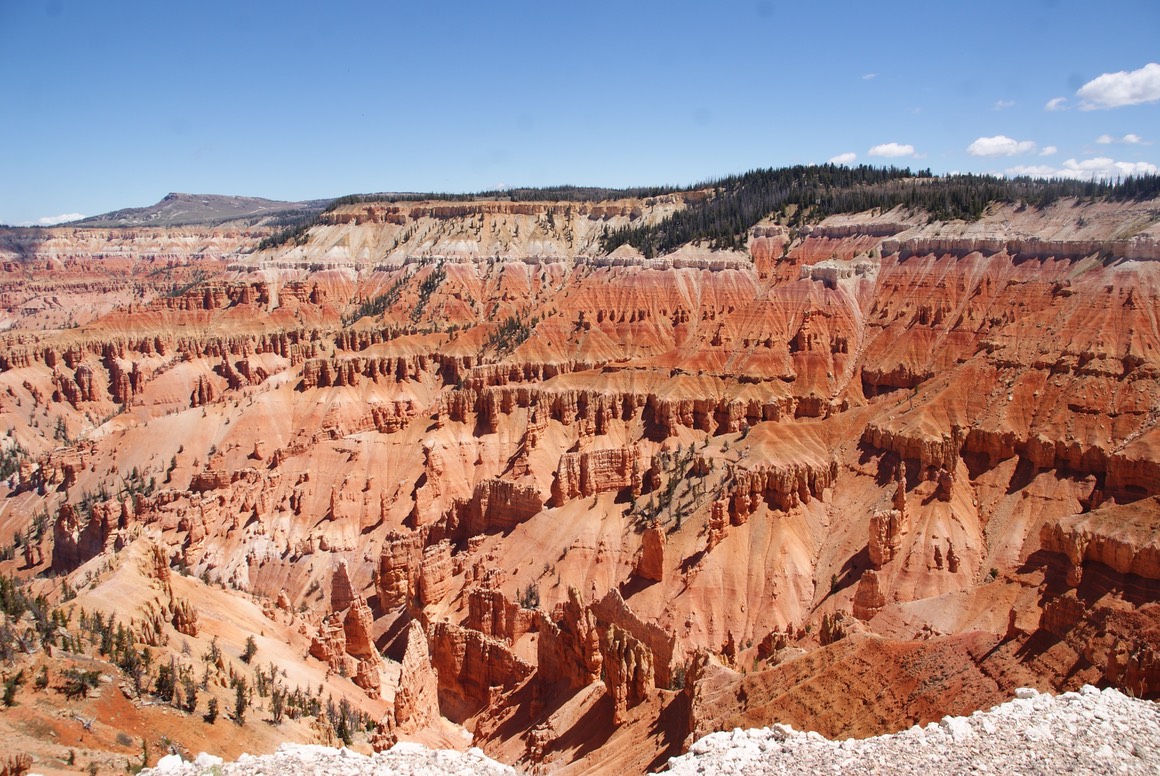
When I pulled up to park my car, I noticed the trailhead I wanted to hike was right in front of me…with a big yellow sign & caution tape stating the trail was closed (super sad face). I walked around a bit, then went into the VC to talk to the Ranger. I told her upfront that I had about a dozen questions & she sweetly said, she loved answering questions (she was very nice). 1. I asked about the burn? it was last year; 70 acres; no lives were lost. 2. I asked about the black rock in the forest? There is volcanic activity underneath this area & when it gets close to the earths service, it comes up from underground causing the forest floor to be filled with volcanic rock. 3. So were these mountains volcanic mountains? No, just activity underneath the earths surface & they even have Lava tubes. 4. Can you hike in the tubes? Yes..did I want to? She’d tell me where they were. No I said. (Danny & I have hiked in some before in Oregon…I don’t crave more hiking underground.) 5. What elevation are we? 10,300’ 6. Did you have an average snow year or a low one? low 7. Where can I go to see a Bristlecone Pine tree? She told me of another place about a mile outside the park (I didn’t want to get my hopes up, but I was kind of excited.) I’m sure I asked her more, but I can’t remember them. She was super nice & it was all so interesting…especially about the volcanic activity under the earths surface…I thought if you had that, you had volcanos, but I guess not.
I took off in search of a Bristlecone Pine trail just west of the park. Luke & Pete live out with the Redwood trees practically in their backyard. These are the tallest trees & so mind blowing & amazing! I’ve also seen Sequoia trees…the largest in diameter which are also magnificent. AND TODAY I GOT TO SEE A BRISTLECONE PINE TREE!! Yes, I know I’m a geek about this, but I was soooo stoked when I found it!
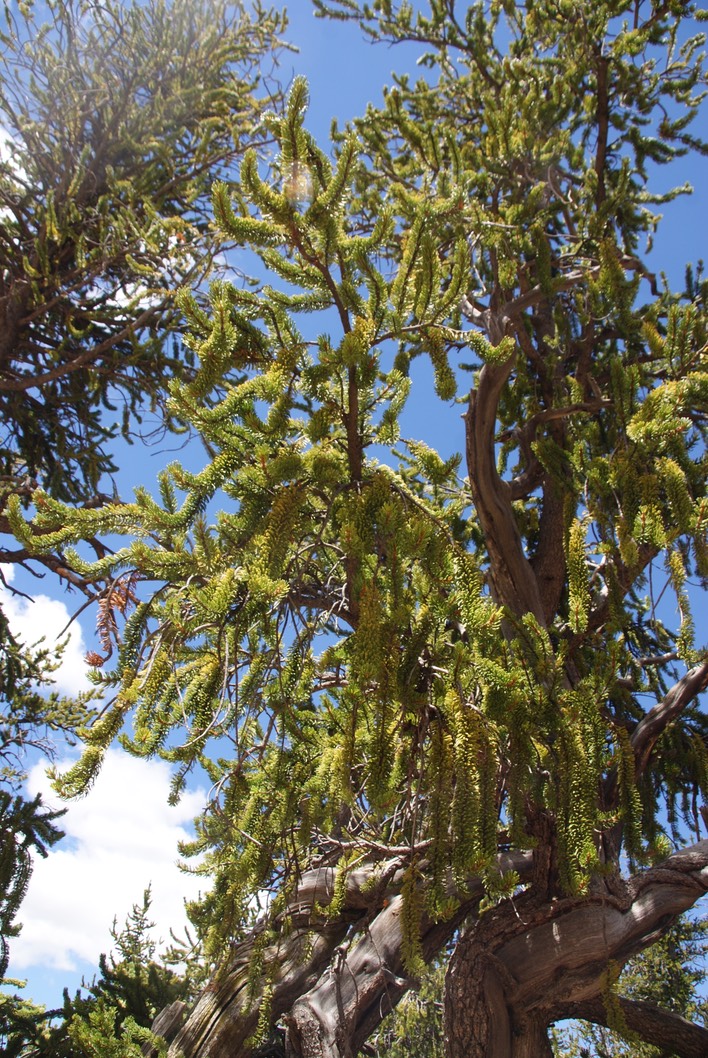
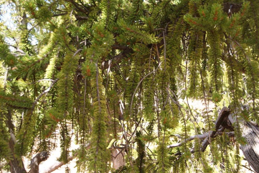
It’s so beautiful & different from any other pines I’ve seen. I was feeling pretty happy about this for sure!
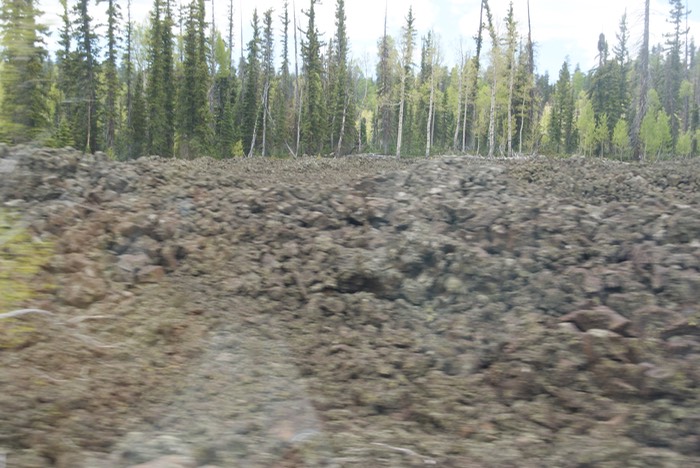
I took a different route back to the highway & it was beautiful too. I was just amazed at these volcanic rocks in the forest..how could trees grow among all this rock? (sorry the pic below on the left is is blurry…I was drive-by shooting). I pulled over at an informational sign in front of this small mountain of volcanic rock…so interesting.
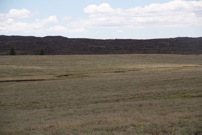
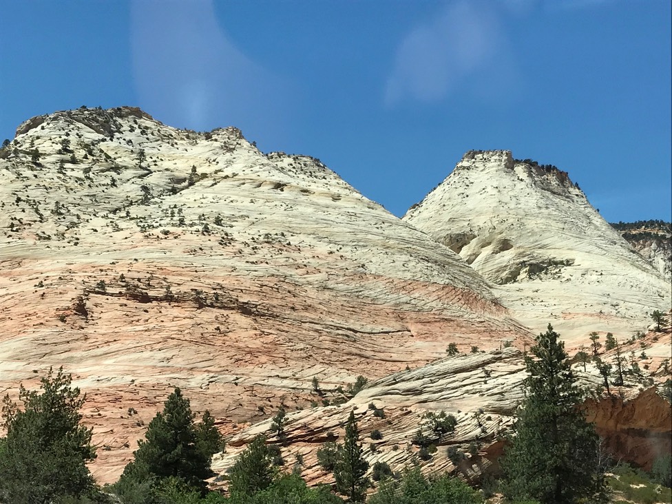
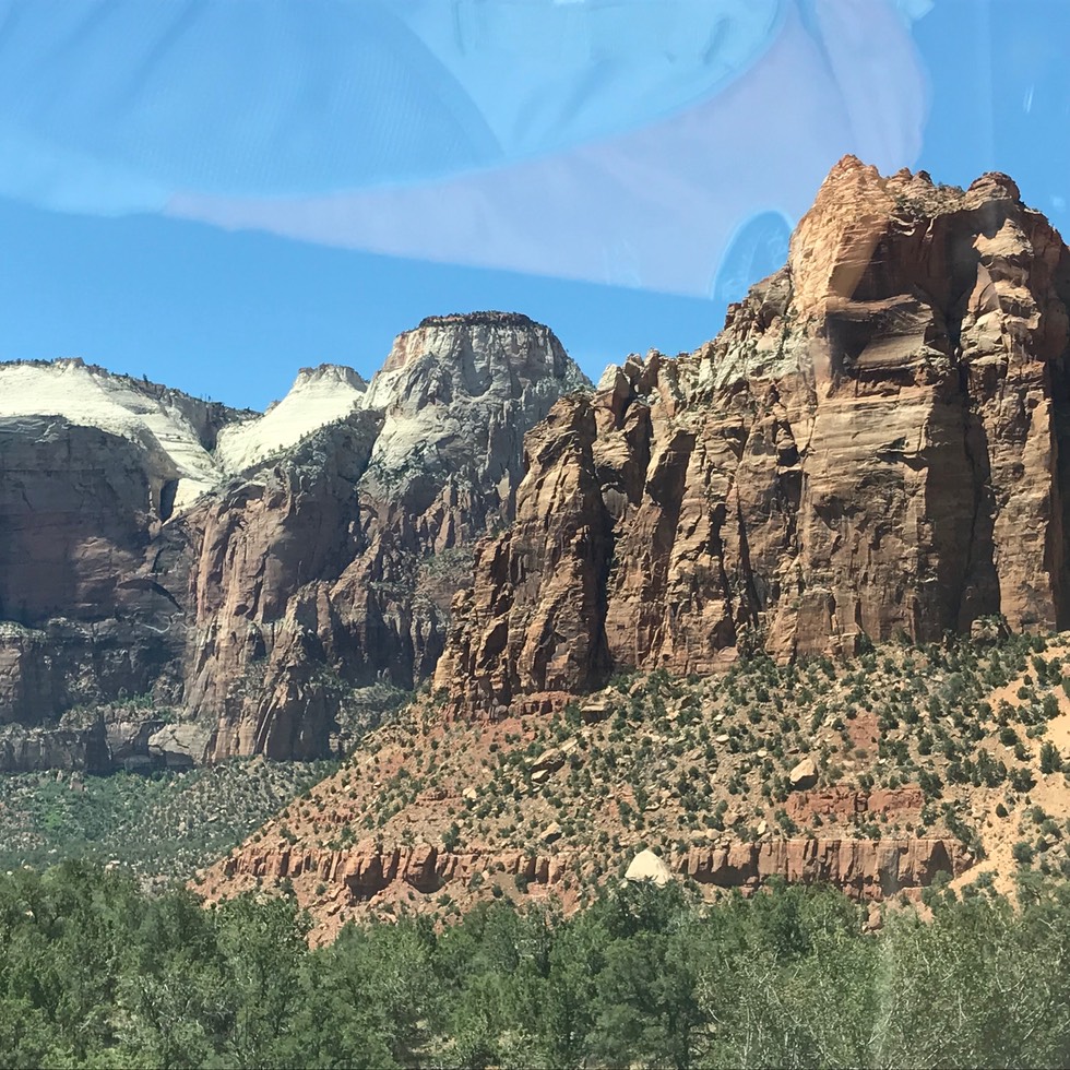
My plan was to drive to a town just this side of Zion NP & get something to eat, find camp, then leave super early the next morning so I could actually get a parking spot inside the park. But, there was no where to eat that looked very good, so I drove on into & through the park. I love this drive…Zion is breathtaking! And the tunnel you drive through is the DARKEST one I’ve ever gone through…only a little creepy. (More drive-by shooting…lots of slow traffic & no where to pull off.)
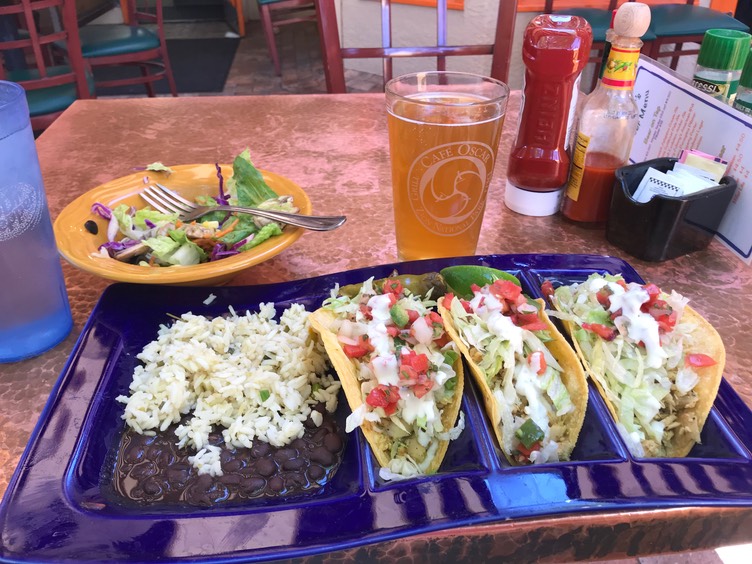
I double checked the campground sign to verify it said FULL. I had checked the website once I knew I was headed into the park, for once I was wilingl to pay to stay in there, but nothing was open. I headed to Oscars Cafe for food…I was tired & hungry. I ordered their fish tacos which came with a super nice salad. I also ordered a Wasatch Jalapeño Cream Ale…have to admit, it was good with my lunch.
Then it was time to find a campsite. I pulled off the road when I saw a sign for Kolob Terrance…didn’t even know what that was. I drove about 15 miles down that road…which actually in part of the park, but no entrance fee or any rangers around. But it was a beautiful drive!
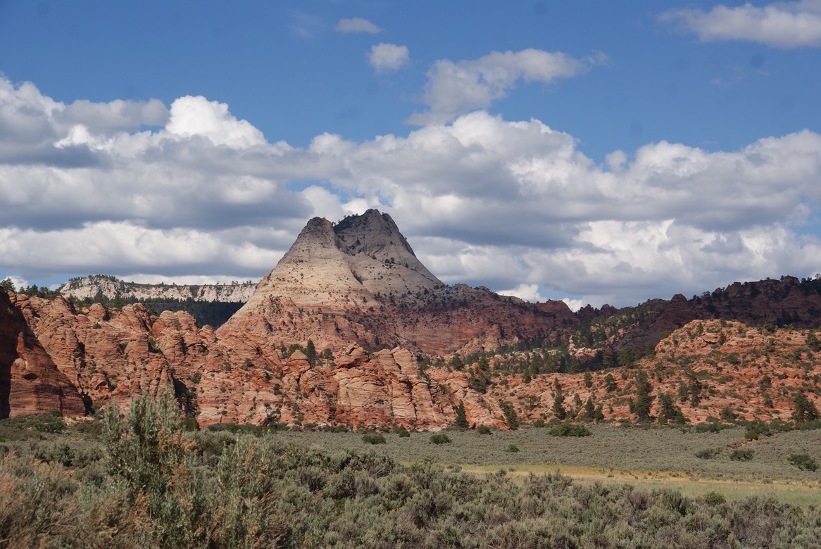
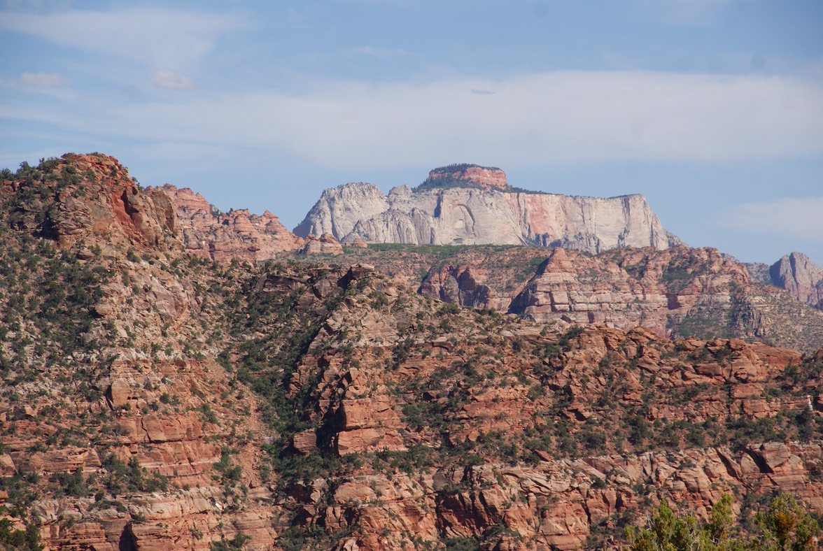
There was no camping along Kolob Terrace, but I found a BLM camping area down the road a few miles & spent a nice evening with a great view. It’s really hot here, but in the shade (which is only from the hatch on my car) it’s really nice. I had cell service, so Danny & I had a nice long visit. The temp was perfect by the time the sunset & the full moon was awesome. I read for a long time, with my hatch open enjoying the moon-view & the nice breeze blowing.
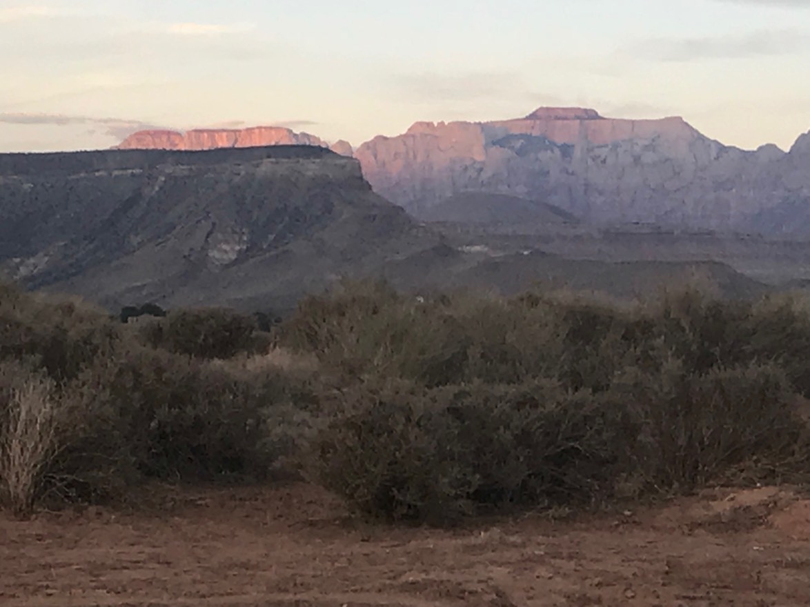
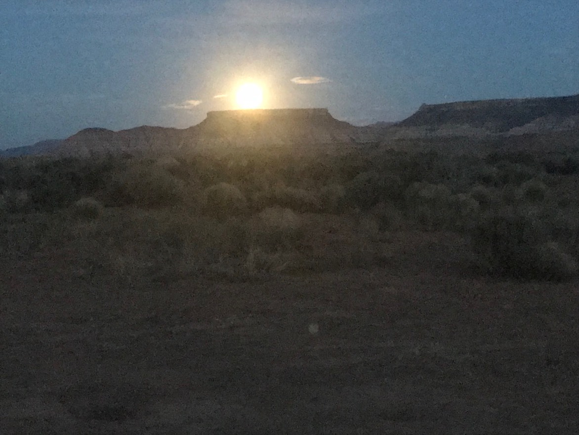
Day 10 5.30 My last day in Utah…
UGH! I slept for about 2 hours last night, so getting up & moving fast was icky when my alarm went off at 6:00am. But, when you’re camping out of your car, it takes about 10 minutes to be from your bed to on the highway….it takes a few minutes to brush your teeth! I was in the park & scored a parking spot & began to slowly get myself ready for today’s big hike. The two iconic Zion hikes are Angels Landing & the Narrows—a slot canyon hike. I’ve hiked both of those before & attempted to do Angels Landing a second time a couple of years ago. I abandoned that plan though, when it snowed overnight up on top of Angels Landing & I didn’t want to be hiking holding on to icy, cold & wet chains with a drop offs all around me. As I made my little breakfast & loaded my pack with water, I saw at least a couple of hundred people running to the shuttle buses to try to be first out. I knew most of them were going to Angels Landing & was glad I wasn’t hiking along those chains with a hundred other people.
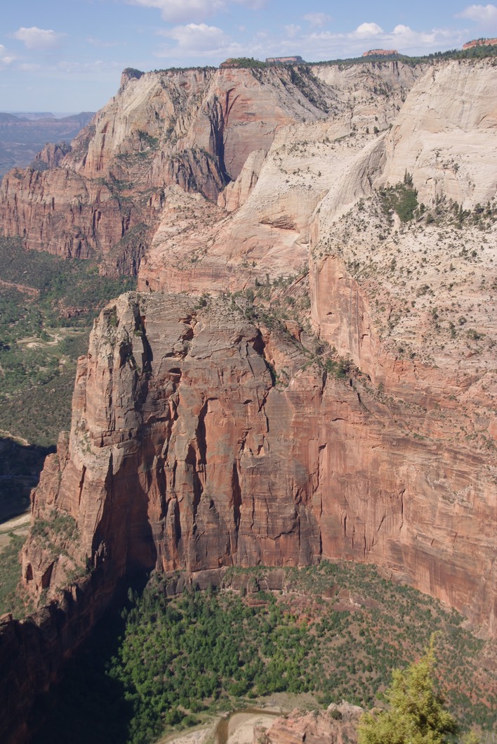
I was hiking Observation Point for the second time…a hard hike (for me anyway), but it’s beautiful. You hike up 2,000’ in 4 miles to way above Angels Landing & above the whole park…it’s a drop dead gorgeous view; even if you sweat like a pig & sound like a freight train during the whole hike. Imagine climbing stairs for two solid hours…that’s what this hike is like.
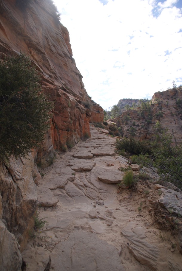
But, I finally made it to the top! Check out this view!
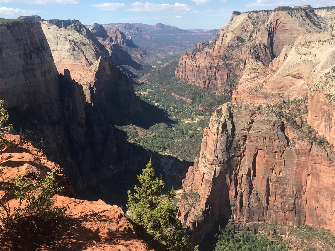
I had my binoculars with me, so I checked out the parade happening on Angels Landing…definitely super glad I wasn’t hiking it today.
So, that pretty much ends my time in Utah. I went back to Oscars for a not-so-great burger but an interesting conversation with a Mom & daughter duo from Canada…they travel all over the world together. I would have much rather talked about their travels than about politics. The mom stated “that it’s got to be awfully embarrassing to be from the US at this political point in time", where it seems our administration is trying to turn back time to exclusivity & white superior attitudes rule. I agreed, but said I didn’t want to discuss it & joked, well it’s not the first time…remember Clinton? I don’t generally discuss politics with anyone except Danny & we don’t always agree.
I drove out of Springdale & left Zion in my rear-view mirror & headed south to St. George where it was 98 degrees & blistering in the sun. It’s a small city like any other…Kohls, TJ Maxx, Best Buy, & every fast food joint you can think of & I headed to Target. I needed some groceries before the next leg of my trip. I made it a fast trip & left & headed out of Utah & into a tiny corner of Arizona onto some more BLM land just off the highway.
Southern Utah is such a wonderful place to play! So beautiful & so much hiking! I’m really hoping, the next time I come back, Danny is with me. I can’t wait to show him this awesome part of the country.
It’s now dark, as I work on my computer, with no one around & only the lights in the distance are from I-15. Tomorrow I will begin a new adventure…going to places I’ve never been before & I’m so stoked about it!